Placerville in El Dorado County, California — The American West (Pacific Coastal)
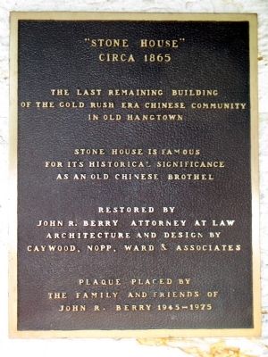
"Stone House"
Circa 1865
Photographed by Syd Whittle, October 10, 2010
1. "Stone House" Marker
of the Gold Rush era Chinese community
in Old Hangtown
Stone House is famous
for its historical significance
as an old Chinese brothel
Restored by
John R. Berry – Attorney at Law
Architectural and design by
Caywood, Nopp, Ward & Associates
Erected by The Family and Friends of John R. Berry 1945 – 1975.
Topics. This historical marker is listed in these topic lists: Asian Americans • Notable Buildings.
Location. 38° 43.614′ N, 120° 48.077′ W. Marker is in Placerville, California, in El Dorado County. It is on Pacific Street 0.1 miles east of California Highway 49, on the right when traveling west. Touch for map. Marker is at or near this postal address: 847 Pacific Street, Placerville CA 95667, United States of America. Touch for directions.

Regionally, this marker is in Sacramento Metro, in the Gold Country, and in the Sierra Nevada. It is also in the American Mountain West. Globally, it is in North America, on the Ring of Fire, on the Pacific Rim, in the Western Hemisphere, in the Western World,
this page online
Other nearby markers. At least 8 other markers are within walking distance of this marker: The Forum Café/Union Hotel/United States Trio Hall (about 600 feet away, measured in a direct line); Hangmans Tree (about 600 feet away); John A. "Snowshoe" Thompson (about 600 feet away); Bayles Building (1853) (about 600 feet away); Branch Saloon/Bingham's Jewelrey/Seligman Building/Ewing Building (about 600 feet away); Snowshoe Thompson (about 700 feet away); Placerville Pony Express (about 700 feet away); Randolph Jewelers (about 700 feet away). Touch for a list and map of all markers in Placerville.
Photographed by Syd Whittle, October 10, 2010
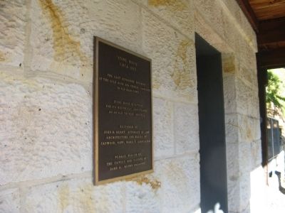
2. "Stone House" Marker
Photographed by Syd Whittle, October 10, 2010
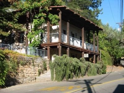
3. Stone House
Photographed by Syd Whittle, October 10, 2010
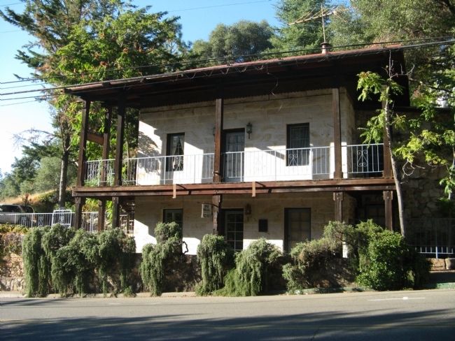
4. Stone House
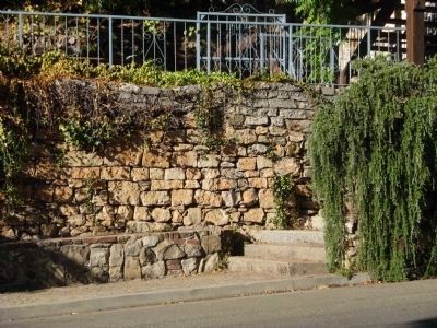
Photographed by Syd Whittle, October 10, 2010
5. Stone Wall to the West of the Building
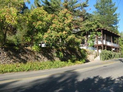
Photographed by Syd Whittle, October 10, 2010
6. Stone Wall and the Stone House
Credits. This page was last revised on June 16, 2016. It was originally submitted on October 10, 2010, by Syd Whittle of Mesa, Arizona. This page has been viewed 3,340 times since then and 181 times this year. Photos: 1, 2, 3, 4, 5, 6. submitted on October 10, 2010, by Syd Whittle of Mesa, Arizona.
