Near New Lisbon in Burlington County, New Jersey — The American Northeast (Mid-Atlantic)
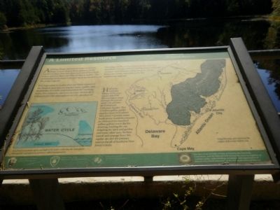
A Limited Resource
It is important to realize that our water resources are limited, and that we impact water quality and availability in subtle and sometimes far reaching ways. For example, mercury (a toxic chemical) is released into the atmosphere as a by-product of burning coal. It can be carried by the wind for hundreds of miles before coming down with rain or snow and contaminating streams, rivers, lakes, the ocean and ultimately the seafood we may eat.
Half of the rainwater falling on the 2,250 square mile Pine Barrens region seeps through the porous sandy soil and into the Kirkwood/Cohansy Aquifer. This 17 trillion gallon aquifer supplies most of Southern New Jersey's potable water. South Jerseys residents consume an estimated two hundred million gallons every day for drinking, washing the car, irrigating the lawn and garden, and many other uses. Surface runoff and seepage from this aquifer are also the primary sources for all of Southern New Jersey's rivers.
Erected by Department of the Interior/National Park Service, State of New Jersey/Department of Parks & Forests, State of New Jersey/The Pinelands Commission.
Topics. This historical marker is listed in these topic lists: Environment • Horticulture & Forestry.
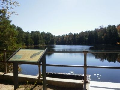
Location. 39° 52.868′ N, 74° 31.95′ W. Marker is near New Lisbon, New Jersey, in Burlington County. Marker can be reached from Coopers Road, 0.1 miles Buzzard Hill Road. Marker is located in Brendan T. Byrne State Forest (formerly Lebanon State Forest) at Pakim Pond. Touch for map. Marker is in this post office area: New Lisbon NJ 08064, United States of America. Touch for directions.
Other nearby markers. At least 8 other markers are within 6 miles of this marker, measured as the crow flies. Central Railroad of New Jersey (approx. 4.3 miles away); The White Horse Inn (approx. 4.3 miles away); Chatsworth Honor Roll (approx. 4.6 miles away); A Million Dollar Resource (approx. 5˝ miles away); Exploring the Pinelands (approx. 5˝ miles away); Whitesbog Village (approx. 5.6 miles away); Conservation and Environmental Studies Center, Inc. (approx. 5.6 miles away); Elizabeth Coleman White (approx. 5.6 miles away).
Credits. This page was last revised on June 16, 2016. It was originally submitted on October 10, 2010, by Deb Hartshorn of Burlington County, New Jersey. This page has been viewed 726 times since then and 25 times this year. Photos: 1, 2, 3, 4. submitted on October 10, 2010, by Deb Hartshorn of Burlington County, New Jersey. • Kevin W. was the editor who published this page.


