Near McCalla in Tuscaloosa County, Alabama — The American South (East South Central)
Tannehill Furnace And Foundry
(1829-1865)
Photographed by Tim & Renda Carr, March 13, 2010
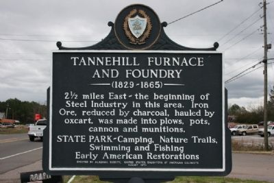
1. Tannehill Furnace And Foundry Marker
2 ½ miles East - the beginning of Steel Industry in this area. Iron Ore, reduced by charcoal, hauled by oxcart, was made into plows, pots, cannon and munitions.
State Park- Camping, Nature Trails, Swimming and Fishing Early American Restorations.
Erected 1972 by Alabama, Society, United States Daughters of American Colonists.
Topics and series. This historical marker is listed in these topic lists: Industry & Commerce • Notable Places. In addition, it is included in the Appalachian Iron Furnaces, and the Daughters of the American Colonists series lists.
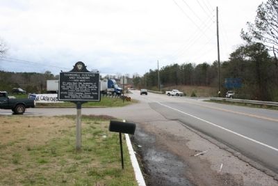
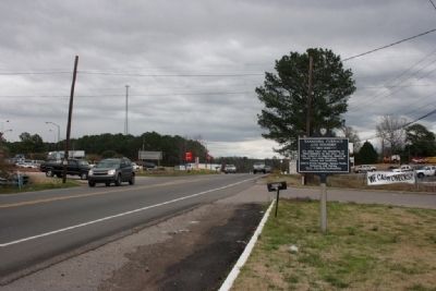
Location. 33° 16.736′ N, 87° 5.602′ W. Marker is near McCalla, Alabama, in Tuscaloosa County. It is on Bucksville Road (Alabama Route 216) east of Interstate 59/20, on the right when traveling east. Touch for map. Marker is at or near this postal address: 22491 Highway 216, Mc Calla AL 35111, United States of America. Touch for directions.

Regionally, this marker is in the American South and specifically in the Deep South. Globally, it is in North America, a Gulf of Mexico state, the Western Hemisphere,
this page online
Other nearby markers. At least 8 other markers are within 3 miles of this marker, measured as the crow flies: Tannehill Ironworks (approx. 2 miles away); John Wesley Hall Grist Mill & Cotton Gin (approx. 2.3 miles away); Old Country Church (approx. 2.3 miles away); Gristmill Trail (approx. 2.3 miles away); The Thompson House (approx. 2.4 miles away); Bagley House (approx. 2.4 miles away); Peel House (approx. 2.4 miles away); Belcher House (approx. 2.4 miles away). Touch for a list and map of all markers in McCalla.
Also see . . . Tannehill Ironworks Historical State Park. Park website homepage (Submitted on May 4, 2021, by Larry Gertner of New York, New York.)
Photographed by Tim & Renda Carr, March 13, 2010
2. Tannehill Furnace And Foundry Marker West View
Photographed by Tim & Renda Carr, March 13, 2010
3. Tannehill Furnace And Foundry Marker East View
Photographed by Tim & Renda Carr
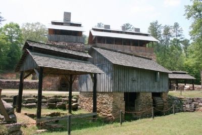
4. Tannehill Furnace And Foundry
Credits. This page was last revised on May 4, 2021. It was originally submitted on October 13, 2010, by Timothy Carr of Birmingham, Alabama. This page has been viewed 1,261 times since then and 33 times this year. Photos: 1, 2, 3, 4. submitted on October 13, 2010, by Timothy Carr of Birmingham, Alabama. • Syd Whittle was the editor who published this page.
