Near Wolcott in Lamoille County, Vermont — The American Northeast (New England)
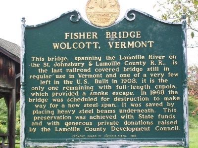
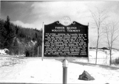
Fisher Bridge
Wolcott, Vermont
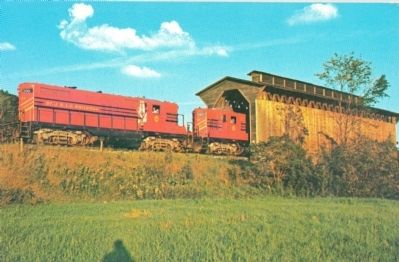
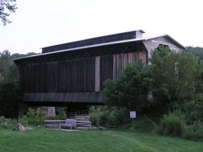
This bridge, spanning the Lamoille River on the St. Johnsbury & Lamoille County R. R., is the last railroad covered bridge still in regular use in Vermont and one of the very few left in the U.S. Built in 1908, it is the only remaining with full-length cupola, which provided a smoke escape. In 1968 the bridge was scheduled for destruction to make way for a new steel span. It was saved by placing heavy steel beams underneath. This preservation was achieved with State funds and with generous private donations raised by the Lamoille County Development Council.
Erected 1968 by Vermont Board of Historic Sites.
Topics and series. This historical marker is listed in these topic lists: Bridges & Viaducts • Railroads & Streetcars. In addition, it is included in the Covered Bridges series list. A significant historical year for this entry is 1908.
Location. 44° 31.968′ N, 72° 25.659′ W. Marker is near Wolcott, Vermont, in Lamoille County. Marker is on Vermont Route 15, on the right when traveling east. Touch for map. Marker is in this post office area: Wolcott VT 05680, United States of America. Touch for directions.
Other nearby markers. At least 8 other markers are within 11 miles of this marker, measured as the crow flies. Reverend George S. Brown (approx. 2 miles away); Camp Wapanacki (approx. 2.4 miles away); Hinman Settler Road (approx. 6.4 miles away); Sterling College (approx. 8½ miles away); Morrisville Depot (approx. 8.7 miles away); Noyes House Museum (approx. 8.8 miles away); Liberty Tree Memorial (approx. 10.7 miles away); To the Memory of Cabot Soldiers (approx. 10.7 miles away).
More about this marker. A roadside park includes a planked overlook at the river for photos and picnicking.
Regarding Fisher Bridge. This railroad line has been abandoned and the track taken up except for the small section that crosses the bridge.
Also see . . . Lamoille Valley RR Fisher Bridge Still Standing?. It is. This discussion includes a detailed description of the bridge and the railroad and contains a number of thumbnail photos of trains crossing the bridge. “The cupola incidentally is another of Fisher Bridge’s distinguishing features, being the only existing bridge with this design characteristic. The cupola originally provided an escape for the smoke and sparks from the steam locomotives but with the ‘iron horses’ now gone it simply provides additional access for the birds whose nests are built in various nooks and crannies in the wooden truss. Interestingly, the original engineering drawings of this bridge do not include the cupola but show only a plain gabled roof. The St. J. and L.C.’s civil engineer had suggested that the nearly full-length cupola was an ‘afterthought’ as the bridge was going up.” (Submitted on July 29, 2010.)
Additional keywords. St. J. & L. C. Railroad
Credits. This page was last revised on November 4, 2020. It was originally submitted on July 29, 2010, by J. J. Prats of Powell, Ohio. This page has been viewed 1,163 times since then and 36 times this year. Last updated on October 14, 2010. Photos: 1. submitted on June 16, 2014, by Kevin Craft of Bedford, Quebec. 2. submitted on July 29, 2010, by J. J. Prats of Powell, Ohio. 3. submitted on August 14, 2010, by J. J. Prats of Powell, Ohio. 4. submitted on June 16, 2014, by Kevin Craft of Bedford, Quebec. • Kevin W. was the editor who published this page.


