Clinton in Hickman County, Kentucky — The American South (East South Central)
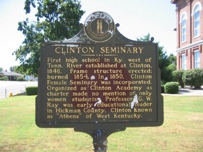
Clinton Seminary
Erected 1974 by Kentucky Historical Society - Kentucky Department of Highways. (Marker Number 1497.)
Topics and series. This historical marker is listed in this topic list: Education. In addition, it is included in the Kentucky Historical Society series list. A significant historical year for this entry is 1846.
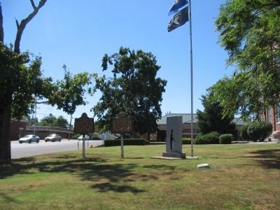
Location. 36° 40.005′ N, 88° 59.631′ W. Marker is in Clinton, Kentucky, in Hickman County. Marker is at the intersection of Washington Street (U.S. 51) and Clay Street (State Highway 58), on the right when traveling south on Washington Street. Located on the east side of the county courthouse. Touch for map. Marker is in this post office area: Clinton KY 42031, United States of America. Touch for directions.
Other nearby markers. At least 8 other markers are within 10 miles of this marker, measured as the crow flies. Hickman County Veterans Memorial (here, next to this marker); County Named, 1821 (here, next to this marker); Guerrilla Raids on Clinton (approx. 0.8 miles away); Casey Jones (approx. 8 miles away); Columbus (approx. 8.8 miles away); Iron Banks (approx. 8.8 miles away); Columbus - A Town Transformed (approx. 9.4 miles away); A River View of History (approx. 9.4 miles away). Touch for a list and map of all markers in Clinton.
Credits. This page was last revised on June 16, 2016. It was originally submitted on October 17, 2010, by Craig Swain of Leesburg, Virginia. This page has been viewed 650 times since then and 31 times this year. Photos: 1. submitted on October 17, 2010, by Craig Swain of Leesburg, Virginia. 2. submitted on October 14, 2010, by Craig Swain of Leesburg, Virginia.

