Morrow in Clayton County, Georgia — The American South (South Atlantic)
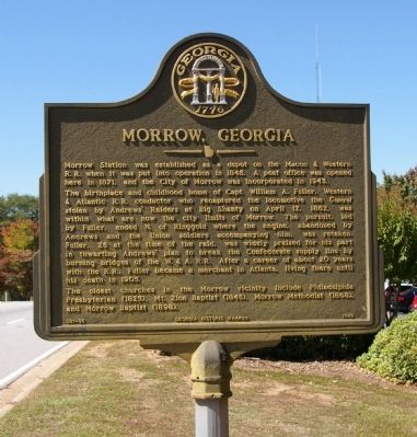
Morrow, Georgia
The birthplace and childhood home of Capt. William A. Fuller, Western & Atlantic R. R. conductor who recaptured the locomotive the General stolen by Andrews’ Raiders at Big Shanty on April 12, 1862, was within what are now the city limits of Morrow. The pursuit, led by Fuller, ended N. of Ringgold where the engine, abandoned by Andrews and the Union soldiers accompanying him, was retaken. Fuller, 26 at the time of the raid, was widely praised for his part in thwarting Andrews’ plan to break the Confederate supply line by burning bridges of the W. & A. R. R. After a career of about 20 years with the R. R., Fuller became a merchant in Atlanta, living there until his death in 1905.
The oldest churches in the Morrow vicinity include Philadelphia Presbyterian (1825), Mt. Zion Baptist (1846), Morrow Methodist (1868), and Morrow Baptist (1898).
Erected 1989 by Georgia Department of Natural Resources. (Marker Number 031-36.)
Topics and series. This historical marker is listed in these topic lists: Churches & Religion • Railroads & Streetcars • War, US Civil. In addition, it is included in the Georgia Historical Society series list. A significant historical month for this entry is April 1831.
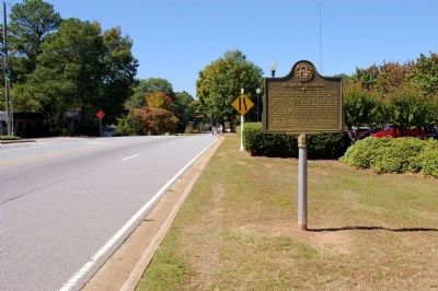
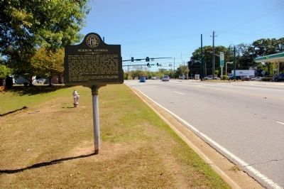
Location. 33° 35.007′ N, 84° 20.41′ W. Marker is in Morrow, Georgia, in Clayton County. Marker is on Morrow Road, 0 miles west of Jonesboro Road (Georgia Route 54), on the right when traveling west. The markers stands at the Morrow City Hall and Police Department. Touch for map. Marker is at or near this postal address: 1500 Morrow Road, Morrow GA 30260, United States of America. Touch for directions.
Other nearby markers. At least 8 other markers are within 4 miles of this marker, measured as the crow flies. Fort Gillem (approx. 2.2 miles away); Flankers Road (approx. 2.3 miles away); Hood Avenue (approx. 2.3 miles away); Iverson Gate (approx. 2.4 miles away); Hardee’s Detour (approx. 2.6 miles away); March and Counter-march (approx. 3.1 miles away); a different marker also named Hood Avenue (approx. 3.4 miles away); Wheeler Drive (approx. 3.4 miles away).
More about this marker. This marker is a replacement for an earlier marker with the same title and text erected by the Georgia Historical Commission at this location, which had disappeared.
Credits. This page was last revised on June 16, 2016. It was originally submitted on October 17, 2010, by David Seibert of Sandy Springs, Georgia. This page has been viewed 1,001 times since then and 46 times this year. Photos: 1, 2, 3. submitted on October 17, 2010, by David Seibert of Sandy Springs, Georgia. • Craig Swain was the editor who published this page.


