Yorktown Heights in Westchester County, New York — The American Northeast (Mid-Atlantic)
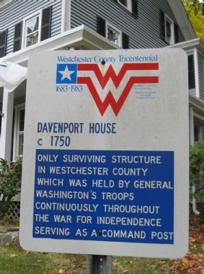
Davenport House
Davenport House
c 1750
Only surviving structure in Westchester County which was held by General Washington's Troops continuously throughout the War for Independence serving as a command post
Westchester County Tricentennial
1683 - 1983
Erected 1983.
Topics and series. This historical marker is listed in this topic list: War, US Revolutionary. In addition, it is included in the Former U.S. Presidents: #01 George Washington series list. A significant historical year for this entry is 1750.
Location. 41° 14.81′ N, 73° 47.019′ W. Marker is in Yorktown Heights, New York, in Westchester County. Marker is at the intersection of Croton Heights Road and Davenport Lane, on the left when traveling west on Croton Heights Road. Touch for map. Marker is at or near this postal address: 648 Croton Heights Road, Yorktown Heights NY 10598, United States of America. Touch for directions.
Other nearby markers. At least 8 other markers are within 4 miles of this marker, measured as the crow flies. Yorktown World War II Monument (approx. 1˝ miles away); Yorktown Korean and Vietnam Wars Monument (approx. 1˝ miles away); Yorktown World War I Monument (approx. 1˝ miles away); French Hill (approx. 2.2 miles away); Yorktown Church (approx. 3˝ miles away); First Presbyterian Church (approx. 3˝ miles away); Black Soldiers of the 1st Rhode Island Regiment (approx. 3˝ miles away); Burial Place (approx. 3˝ miles away). Touch for a list and map of all markers in Yorktown Heights.
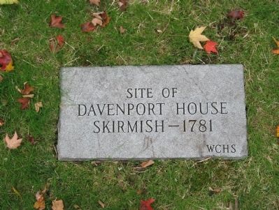
Regarding Davenport House. The relatively small Battle of Pines Bridge, a nearby crossing point of the Croton River, included fighting at the Davenport House, where many of these soldiers died.
Related markers. Click here for a list of markers that are related to this marker. Markers related to the Battle of Pines Bridge
Additional commentary.
1.
This is my 6th Great Grandfather!
Richardson Davenport 1732-1808
6th great-grandfather
Rachel Davenport 1753-1836
Daughter of Richardson Davenport
John Carpenter 1771-1826
Son of Rachel Davenport
Mary Carpenter 1791-1875
Daughter of John Carpenter
Henry Carpenter Putney 1833-1907
Son of Mary Carpenter
Frank Carpenter Putney 1876-1940
Son of Henry Carpenter Putney
Elnora Grace Putney 1906-1990
Daughter of Frank Carpenter Putney
Elnora J (Hoagland) Gizzie 1930-
Daughter of Elnora Grace Putney
Karen J Gizzie
You are the daughter of Elnora J (Hoagland) Gizzie
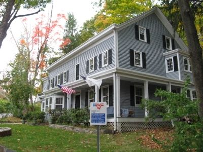
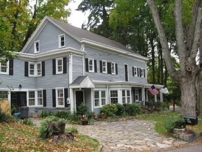
The historic Davenport House, Yorktown, NY, owned and operated by Richardson Davenport during the Revolutionary War as an inn and site of the May 13, 1781 Battle of Pines Bridge, where a Tory force surprised the First Rhode Island Regiment, a Patriot force staying at the Inn, killing several members of the Patriot forces. Among those killed in the skirmish were several African-American soldiers, whose participation and deaths are memorialized by a plaque at the Yorktown Presbyterian Church. The Inn served as a command center for George Washington's troops. The Davenport House is designated as a historic landmark by the Town of Yorktown, Westchester County and New York State. Photo courtesy of the Yorktown Historical Society.
— Submitted March 5, 2021, by Karen Joy Gizzie of Worcester, Massachusetts.
Credits. This page was last revised on March 6, 2021. It was originally submitted on October 19, 2010, by Michael Herrick of Southbury, Connecticut. This page has been viewed 3,411 times since then and 147 times this year. Photos: 1, 2, 3, 4. submitted on October 19, 2010, by Michael Herrick of Southbury, Connecticut.


