Western Branch North in Portsmouth, Virginia — The American South (Mid-Atlantic)
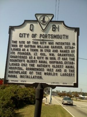
City of Portsmouth
Erected 1959 by Virginia State Library. (Marker Number Q 8-i.)
Topics and series. This historical marker is listed in these topic lists: Military • Settlements & Settlers. In addition, it is included in the Virginia Department of Historic Resources (DHR) series list. A significant historical year for this entry is 1659.
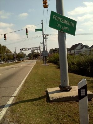
Location. 36° 51.681′ N, 76° 23.946′ W. Marker is in Portsmouth, Virginia. It is in Western Branch North. Marker is at the intersection of High Street West (U.S. 17) and Academy Avenue, on the right when traveling east on High Street West. Touch for map. Marker is in this post office area: Portsmouth VA 23703, United States of America. Touch for directions.
Other nearby markers. At least 8 other markers are within 4 miles of this marker, measured as the crow flies. Huntersville Rosenwald School (approx. 1.9 miles away); Craney Island (approx. 2.2 miles away); The Battle of Craney Island (approx. 2.2 miles away); A Living Memorial (approx. 2.6 miles away); General Lafayette Memorial (approx. 2.6 miles away); V. C. Andrews Monument (approx. 2.8 miles away); Lest We Forget (approx. 2.9 miles away); Benedict Arnold at Portsmouth (approx. 3.6 miles away). Touch for a list and map of all markers in Portsmouth.
More about this marker. This marker is numbered Q-8-L in the 2007 third edition of A Guidebook to Virginia Historical Markers by Scott David Arnold.
Credits. This page was last revised on February 1, 2023. It was originally submitted on October 19, 2010, by James Thomson of Chesapeake, United States. This page has been viewed 799 times since then and 22 times this year. Photos: 1, 2. submitted on October 19, 2010, by James Thomson of Chesapeake, United States. • Syd Whittle was the editor who published this page.

