Marker Logo HMdb.org THE HISTORICAL
MARKER DATABASE
“Bite-Size Bits of Local, National, and Global History”
Milton in Sussex County, Delaware — The American Northeast (Mid-Atlantic)
 

Milton


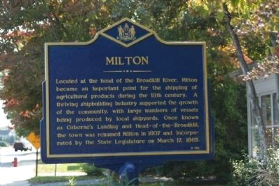
Milton Marker image. Click for full size.
Photographed By Mike Stroud, October 12, 2010
1. Milton Marker
Inscription. Located at the head of the Broadkill River, Milton became an important point for the shipping of agricultural products during the 18th century. A thriving shipbuilding industry supported the growth of the community, with large numbers of vessels being produced by local shipyards. Once known as Osborne’s Landing and Head-of-the-Broadkill, the town was renamed Milton in 1807 and incorporated by the State Legislature on March 17, 1865.
 
Erected by Delaware Public Archives. (Marker Number SC-83.)
 
Topics and series. This historical marker is listed in these topic lists: Industry & CommerceSettlements & Settlers. In addition, it is included in the Delaware Public Archives series list. A significant historical month for this entry is March 1875.
 
Location. 38° 47.271′ N, 75° 18.938′ W. Marker is in Milton, Delaware, in Sussex County. Marker is on Union Street (Delaware Route 5) near Beach Highway (Delaware Route 16), on the right when traveling south. Touch for map. Marker is in this post office area: Milton DE 19968, United States of America. Touch for directions.
 
Other nearby markers. At least 8 other markers are within walking distance of this marker. Milton Public School #196-C (approx. 0.2 miles away); Carey Storehouse (approx. 0.6 miles away); In Recognition Of Bryan Stevenson (approx. 0.6 miles away); Honor Roll
Paid Advertisement
Click on the ad for more information.
Please report objectionable advertising to the Editor.
Click or scan to see
this page online
(approx. 0.6 miles away); Milton Museum (approx. 0.6 miles away); a different marker also named Honor Roll (approx. 0.6 miles away); Ships and Men (approx. 0.7 miles away); Governor David Hazzard (approx. 0.7 miles away). Touch for a list and map of all markers in Milton.
 
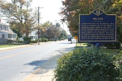
Milton Marker, looking south along Union Street (State Route 5) image. Click for full size.
Photographed By Mike Stroud, October 12, 2010
2. Milton Marker, looking south along Union Street (State Route 5)
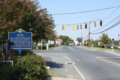
Milton Marker, near the intersection of Route 5 , and Beach Highway, Route 16 image. Click for full size.
Photographed By Mike Stroud, October 12, 2010
3. Milton Marker, near the intersection of Route 5 , and Beach Highway, Route 16
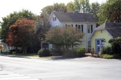
Milton Marker on Union Street, (DE 5) image. Click for full size.
Photographed By Mike Stroud, October 12, 2010
4. Milton Marker on Union Street, (DE 5)
 
 
Credits. This page was last revised on June 16, 2016. It was originally submitted on October 21, 2010, by Mike Stroud of Bluffton, South Carolina. This page has been viewed 577 times since then and 8 times this year. Photos:   1, 2, 3. submitted on October 21, 2010, by Mike Stroud of Bluffton, South Carolina.   4. submitted on October 31, 2010, by Mike Stroud of Bluffton, South Carolina.
Share this page.  
Share on Tumblr
m=37125

CeraNet Cloud Computing sponsors the Historical Marker Database.
This website earns income from purchases you make after using our links to Amazon.com. We appreciate your support.
Paid Advertisement
Apr. 24, 2024