Collierville in Shelby County, Tennessee — The American South (East South Central)
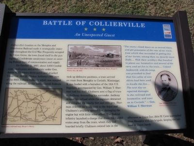
Battle of Collierville
An Unexpected Guest
On October 11, 1863, about 3,000 Confederate cavalrymen and artillerists under Gen. James R. Chalmers drove north and attacked Union Col. DeWitt Clinton Anthony's 600 men of the 66th Indiana Infantry, which was camped along the railroad. As the outnumbered Federals took up defensive positions, a train arrived en route from Memphis to Corinth, Mississippi. It was loaded with a battalion of the 13th U.S. Regulars, accompanied by Gen. William T. Sherman and his staff. Chalmers sent a flag of truce to Anthony, demanding his surrender. Anthony delayed his refusal while the regulars detrained and occupied the nearby fort and rifle pits. Sherman ordered the train back to the depot and Chalmers' artillery opened fire, damaging the engine but with little other effect. The Federal infantry launched a charge that drove the Confederates away from the train, which they had boarded briefly. Chalmers retired late in the afternoon as Union Gen. John M. Corse approached from Memphis with his brigade, keeping the railroad in Union hands.
"The enemy closed down on us several times, and got possession of the rear of our train, from which they succeeded in getting five of our horses, among them my favorite mare Dolly....With their artillery they knocked to pieces our locomotive and several of the cars, and set fire to the train....Colonel Audenreid, aide-de-camp, was provoked to find that his valise of nice shirts had been used to kindle the fire.... The next day we repaired damages to the railroad and locomotive, and went on to Corinth." - Gen. William T. Sherman
Erected by Tennessee Civil War Trails.
Topics and series. This historical marker is listed in this topic list: War, US Civil. In addition, it is included in the Tennessee Civil War Trails series list. A significant historical month for this entry is October 1819.
Location. 35° 2.619′ N, 89° 40.004′ W. Marker is in Collierville, Tennessee, in Shelby County. Marker is on Walnut Street south of West Poplar Avenue (Tennessee Highway 57), on the right when traveling south. Located adjacent to Collierville's Tom Brooks Park. Touch for map. Marker is in this post office area: Collierville TN 38017, United States of America. Touch for directions.
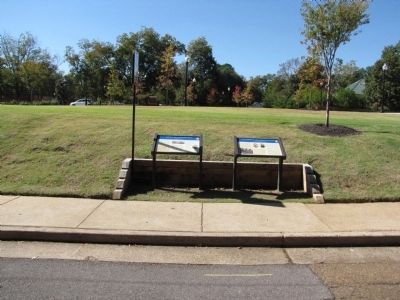
Other nearby markers. At least 8 other markers are within walking distance of this marker. Chalmers's Collierville Raid (here, next to this marker); Civil War Walking Trail Start/End Kiosk (a few steps from this marker); Fort/Stockade (a few steps from this
marker); First Baptist Church (within shouting distance of this marker); Treating the Wounded (within shouting distance of this marker); Tom Brooks Park (within shouting distance of this marker); Saint Andrew's Episcopal Church (within shouting distance of this marker); Presbyterian Church of Collierville (within shouting distance of this marker). Touch for a list and map of all markers in Collierville.
Credits. This page was last revised on June 16, 2016. It was originally submitted on October 26, 2010, by Lee Hattabaugh of Capshaw, Alabama. This page has been viewed 1,519 times since then and 42 times this year. Photos: 1, 2, 3. submitted on October 26, 2010, by Lee Hattabaugh of Capshaw, Alabama. • Craig Swain was the editor who published this page.


