Collierville in Shelby County, Tennessee — The American South (East South Central)
Chalmers's Collierville Raid
"... break the railroad behind him."
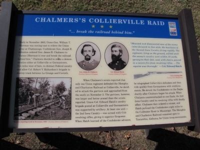
When Chalmers's scouts reported that only one Union regiment defended the Memphis and Charleston Railroad at Collierville, he decided to attack the garrison and approached from the south on November 3. The garrison, however, was larger and better armed than the scouts reported. Union Col. Edward Hatch's cavalry brigade posted at Collierville and Germantown was supported by artillery. At least one unit - the 2nd Iowa Cavalry - was armed with Colt revolving rifles, giving it superior firepower.
When Hatch learned of the Confederate advance, he telegraphed Collierville's defenders and then rode quickly from Germantown with reinforcements. He struck the Confederates on the flanks shortly after Chalmers began his attack. When Chalmers counterattacked on one flank, the 2nd Iowa Cavalry used its revolving rifles with deadly effect. Chalmers then ordered a retreat, and Hatch pursued the Confederates eight miles to the Coldwater River in Mississippi. The Memphis and Charleston Railroad remained open to Tuscumbia, Alabama, for Union troop movements.
"Mounted and dismounted men of the enemy came forward in fine style, the howitzers of the Second Iowa Cavalry firing rapidly. The regiment, lying on the ground, waited until the enemy's cavalry were within 50 yards, sprang to their feet, and, with cheers, poured in a severe fire from revolving rifles. ... The repulse was thorough." - Col. Edward Hatch
Erected by Tennessee Civil War Trails.
Topics and series. This historical marker is listed in this topic list: War, US Civil. In addition, it is included in the Tennessee Civil War Trails series list. A significant historical month for this entry is November 1863.
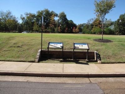
Location. 35° 2.62′ N, 89° 40.004′ W. Marker is in Collierville, Tennessee, in Shelby County. Marker is on Walnut Street south of West Poplar Avenue (Tennessee Highway 57), on the right when traveling south. Located adjacent to Collierville's Tom Brooks Park. Touch for map. Marker is in this post office area: Collierville TN 38017, United States of America. Touch for directions.
Other nearby markers. At least 8 other markers are within walking distance of this marker. Battle of Collierville (here, next to this marker); Civil War Walking Trail Start/End Kiosk (a few steps from this marker); Fort/Stockade
(a few steps from this marker); First Baptist Church (within shouting distance of this marker); Tom Brooks Park (within shouting distance of this marker); Treating the Wounded (within shouting distance of this marker); Saint Andrew's Episcopal Church (within shouting distance of this marker); Presbyterian Church of Collierville (within shouting distance of this marker). Touch for a list and map of all markers in Collierville.
Related markers. Click here for a list of markers that are related to this marker. To better understand the relationship, study each marker in the order shown.
Credits. This page was last revised on April 6, 2018. It was originally submitted on October 26, 2010, by Lee Hattabaugh of Capshaw, Alabama. This page has been viewed 1,285 times since then and 34 times this year. Photos: 1, 2, 3. submitted on October 26, 2010, by Lee Hattabaugh of Capshaw, Alabama. • Craig Swain was the editor who published this page.


