Millsboro in Sussex County, Delaware — The American Northeast (Mid-Atlantic)
The Ableman Homestead
Photographed by Mike Stroud, October 13, 2010
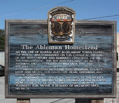
1. The Ableman Homestead Marker
An inn, one of several built in Delaware towns during this period, was established on this corner at the end of the 18th century and remained open until the end of the 19th century. This site was purchased by Abel Ableman and occupied from 1902 until 1987, and the old inn was used as the family home for the family of Abel and Fannie Ableman including sons Benjamin, Maurice, Louie and Meyer, and daughters Pearl Greenberg and Minnie Goldstrum.
A contribution towards the purchase of this facility by the Town of Millsboro was provided in 1992 in loving memory of the Ableman family by Abel Ableman's youngest son, Meyer, a resident of Millsboro since his birth.
Erected by Town of Millsboro, Delaware.
Topics. This historical marker is listed in this topic list: Industry & Commerce. A significant historical year for this entry is 1902.
Location. This marker has been replaced by another marker nearby. It was located near 38° 35.493′ N, 75° 17.488′ W. Marker was in Millsboro, Delaware, in Sussex County. It was on Main Street (Delaware Route 24/30) near West State Street (County Route 326), on the left when traveling north.
this page online

Regionally, this marker was on Delaware’s Beaches. It was also in the American Mid-Atlantic, on the Delmarva Peninsula, and on the Eastern Seaboard. Globally, it was in the North Atlantic Region, North America, the Western Hemisphere, the Western World, and the Anglosphere. Historically, it found itself in what was once New Netherland, one of the original Thirteen Colonies, and the Antebellum South.
Other nearby markers. At least 8 other markers are within walking distance of this location: A different marker also named The Ableman Homestead (here, next to this marker); Millsboro's Oldest Commercial Structure: The Benjamin Burton Store, a part of the town's history (within shouting distance of this marker); Ball Theatre/Millstone Theatre (within shouting distance of this marker); Home of John J. Williams (within shouting distance of this marker); Saint Mark's Episcopal Church (about 500 feet away, measured in a direct line); Grace United Methodist Church (about 600 feet away); Home of Richard S. Cordrey
Photographed by Mike Stroud, October 13, 2010
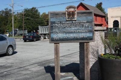
2. The Ableman Homestead (and Marker) as a city parking lot today
Regarding The Ableman Homestead. Today, a city public parking lot is at this corner site
Related marker. Click here for another marker that is related to this marker. This marker has been replaced with the linked marker.
Photographed by Mike Stroud, October 13, 2010
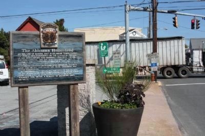
3. The Ableman Homestead Marker
The SW corner of Main Street (SR 24) and West State Street
Credits. This page was last revised on October 6, 2024. It was originally submitted on October 27, 2010, by Mike Stroud of Bluffton, South Carolina. This page has been viewed 1,139 times since then and 51 times this year. Photos: 1, 2, 3. submitted on October 27, 2010, by Mike Stroud of Bluffton, South Carolina.
