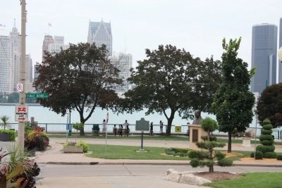
Windsor in Essex County, Ontario — Central Canada (North America)
French Settlement on the South Shore
Inscription.
Front - In English
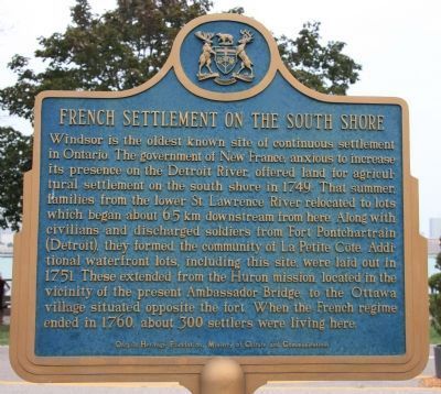
Windsor is the oldest known site of continuous settlement in Ontario. The government of New France, anxious to increase its presence on the Detroit River, offered land agricultural settlement on the south shore in 1749. That summer families from the lower St. Lawrence River relocated to lots which began about 6.5 km downstream from here. Along with civilians and discharged soldiers from Fort Pontchartrain (Detroit), they formed the community of La Petite Cote. Additional waterfront lots, including this site, were laid out in 1751. These extended from the Huron mission located in the vicinity of the present Ambassador Bridge, to the Ottawa village situated opposite the fort. When the French regime ended in 1760, about 300 settlers were living here.
Reverse - In French
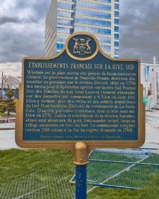
Établissement français sur la rive sud. Windsor est le plus ancien site peuplé de façon continue en Ontario. Le gouvernement de la Nouvelle-France, désireux d'intensifier sa présence sur la rivière Détroit, offre, en 1749, des terres pour l'exploitation agricole sur la rive Sud. Pendant l'été, des familles du bas Saint Laurent viennent s'intaller sur des parcelles qui commencent à 6,5 kilomètres en aval d'ici. Elles forment, avec des civils et des soldats démobilisés du Fort Pontchartrain (Detroit), la communauté de La Petite Côte. D'autres parcelles riveraines, dont ce site, sont établies en 1751. Celles-ci s'étendent de la mission huronne, située aux alentours du pont Ambassador actuel, jusqu'au village outaouais en face du fort. La communauté comptait environ 300 colons à la fin du régime français en 1760."
Erected by the Ontario Heritage Foundation, Ministry of Culture and Communications.
Topics. This historical marker is listed in these topic lists: Settlements & Settlers • War, French and Indian. A significant historical year for this entry is 1749.
Location. 42° 19.213′ N, 83° 2.434′ W. Marker is in Windsor, Ontario, in Essex County. Marker is at the intersection of Ouellette Avenue and Viale Udine, on the right when traveling north on Ouellette Avenue. This historical marker is located in the downtown area, in the community's public park, on the Detroit River, directly across the river from downtown Detroit, Michigan. Touch for map. Marker is in this post office area: Windsor ON N9A 6T3, Canada. Touch for directions.
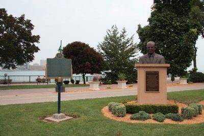
Other nearby markers. At least 8 other markers are within walking distance of this marker. The Rt. Hon. Herb Gray, PC., C.C., Q.C. (here, next to this marker); The Detroit River (about 120 meters away, measured in a direct line); The Great Western Railway (about 180 meters away); The Francois Baby House (approx. 0.2 kilometers away); The Battle of Windsor - 1838 (approx. 0.3 kilometers away); Mary Ann Shadd Cary (1823-1893) (approx. 0.3 kilometers away); The Underground Railroad in Canada (approx. 0.3 kilometers away); Original Home of Major F.A. Tilston V.C. Armoury (approx. 0.3 kilometers away). Touch for a list and map of all markers in Windsor.
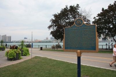
Photographed By Dale K. Benington, August 9, 2010
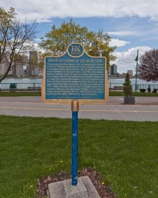
4. French Settlement on the South Shore Marker
View looking northeast, with the historical marker in the foreground, and in the background the Windsor downtown walkway, and then the Detroit River, and beyond the river, a view of downtown Detroit, Michigan.
Credits. This page was last revised on June 16, 2016. It was originally submitted on October 28, 2010, by Dale K. Benington of Toledo, Ohio. This page has been viewed 1,681 times since then and 32 times this year. Photos: 1. submitted on October 29, 2010, by Dale K. Benington of Toledo, Ohio. 2. submitted on May 10, 2011, by Ronald Claiborne of College Station, Texas. 3, 4. submitted on October 29, 2010, by Dale K. Benington of Toledo, Ohio. 5. submitted on May 10, 2011, by Ronald Claiborne of College Station, Texas. 6. submitted on October 29, 2010, by Dale K. Benington of Toledo, Ohio.
