Murfreesboro in Rutherford County, Tennessee — The American South (East South Central)
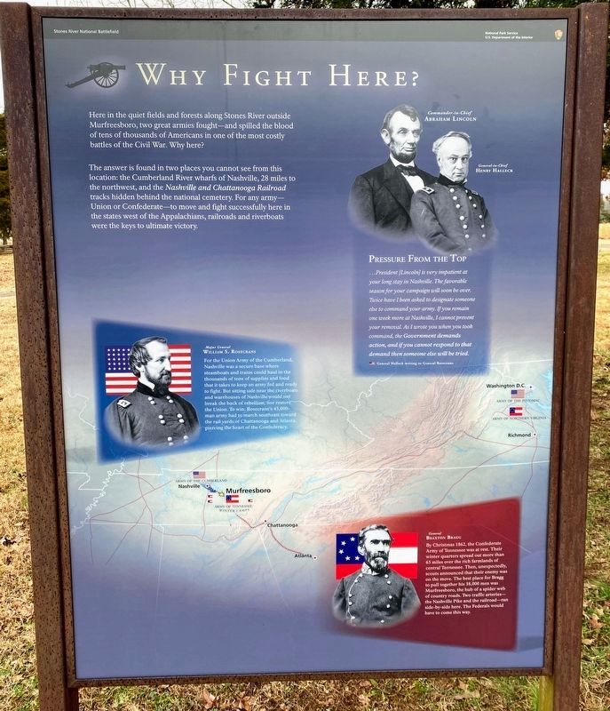
Why Fight Here?
The answer is found in two places you cannot see from this location: the Cumberland River wharfs of Nashville, 28 miles to the northwest, and the Nashville and Chattanooga Railroad tracks hidden behind the national cemetery. For any army - Union or Confederate - to move and fight successfully here in the states west of the Appalachians, railroads and riverboats were the keys to ultimate victory.
Pressure from the Top
...President [Lincoln] is very impatient at your long stay in Nashville. The favorable season for your campaign will soon be over. Twice have I been asked to designate someone else to command your army. If you remain one week more at Nashville, I cannot prevent your removal. As I wrote you when you took command, the Government demands action, and if you cannot respond to that demand then someone else will be tried.
General Halleck writing to General Rosecrans.
Major General William S. Rosecrans
For the Union Army of the Cumberland, Nashville was a secure base where steamboats and trains could haul in the thousands of tons of supplies and food that it takes to keep an army fed and ready to fight. But sitting safe near the riverboats and warehouses of Nashville would not break the back of the rebellion, nor restore the Union. To win, Rosecrans's 43,000-man army had to march southeast toward the rail yards of Chattanooga and Atlanta piercing the heart of the Confederacy.
General Braxton Bragg
By Christmas 1862, the Confederate Army of the Tennessee was at rest. Their winter quarters spread out more than 65 miles over the rich farmlands of central Tennessee. Then, unexpectedly, scouts announced that their enemy was on the move. The best place for Bragg to pull together his 38,000 men was Murfreesboro, the hub of a spider web of country roads. Two traffic arteries - the Nashville Pike and the railroad - ran side-by-side here. The Federals would have to come this way.
Erected by Stones River National Battlefield - National Park Service - U.S. Department of the Interior.
Topics and series. This historical marker is listed in this topic list: War, US Civil. In addition, it is included in the Former U.S. Presidents: #16 Abraham Lincoln series list. A significant historical year for this entry is 1862.
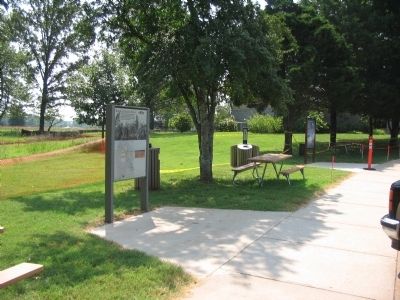
Location. 35° 52.859′ N, 86° 26.081′ W. Marker is in Murfreesboro, Tennessee, in Rutherford County. Marker is at the intersection of Old Nashville Highway and Park Road, on the right when traveling south on Old Nashville Highway. Located at the Visitor Center of Stones River National Battlefield. Touch for map. Marker is in this post office area: Murfreesboro TN 37129, United States of America. Touch for directions.
Other nearby markers. At least 8 other markers are within walking distance of this marker. Battle at Stones River (a few steps from this marker); The Charge Kept Coming, Coming Like the Sea (within shouting distance of this marker); Passing Through Murfreesboro (within shouting distance of this marker); Their Longest, Coldest New Year’s Eve (within shouting distance of this marker); God has granted us a Happy New Year! (within shouting distance of this marker); Stand Fast! (about 400 feet away, measured in a direct line); This "Precious Dust" (about 400 feet away); A Patriotic Pulpit (about 600 feet away). Touch for a list and map of all markers in Murfreesboro.
Also see . . . Stones River National Battlefield. National Park Service site. (Submitted on October 31, 2010, by Craig Swain of Leesburg, Virginia.)
Credits. This page was last revised on March 15, 2021. It was originally submitted on October 31, 2010, by Craig Swain of Leesburg, Virginia. This page has been viewed 826 times since then and 14 times this year. Photos: 1. submitted on March 13, 2021, by Shane Oliver of Richmond, Virginia. 2. submitted on October 31, 2010, by Craig Swain of Leesburg, Virginia.

