Ontario in San Bernardino County, California — The American West (Pacific Coastal)
Mule Car
| — | 1888 - 1895 | — |
Photographed by Joseph Beeman, April 9, 2006
1. Mule Car Marker
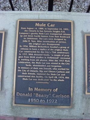
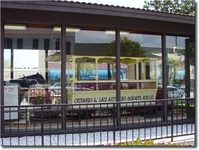
From August 14, 1888, to September 24th, 1895, the Ontario & San Antonio Heights R.R. Company’s gravity mule car transported citizens up-and-down Euclid Avenue from Holt Boulevard to 24th Street. The cars were designed by John H. Tayes. After the termination of service, the original cars disappeared.
In 1956, William Richardson headed a group of citizens to have a replica of the original Mule Car constructed for the city's 75th anniversary in 1957. With donated funds "a couple of prop guys from the MGM Studios in Hollywood" recreated it, working from old photos. After the 1957 Mule celebration, the Mule Car was stored in the City Yards, abandoned and forgotten.
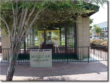
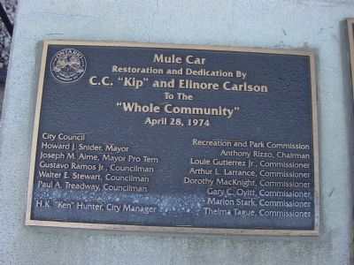
In memory of their son Donald, who worked for the City of Ontario, Kip and Elinore Carlson and their friends restored the Mule Car and constructed this facility. On April 28, 1974, this Mule Car was dedicated "to the whole community."
In memory of Donald "Beany" Carlson, 1950 to 1972.
Erected 2000.
Topics. This historical marker is listed in this topic list: Railroads & Streetcars. A significant historical month for this entry is April 1850.
Location. 34° 3.866′ N,
this page online

Regionally, this marker is in Greater Los Angeles, in the Inland Empire, in the Peninsular Ranges, and specifically in the Transverse Ranges. It is also in the American Southwest. Globally, it is in North America, on the Ring of Fire, on the Pacific Rim, in the Western Hemisphere, in the Western World, and in the Anglosphere. Historically, it finds itself in what was once New Spain and also Mexico’s Alta California.
Other nearby markers. At least 8 other markers are within walking distance of this marker: Nine Young Pepper Trees (about 300 feet away, measured in a direct line); Ontario Town Square (about 400 feet away); Ontario Masonic Hall (about 400 feet away); McCann Block Building (about 500 feet away); WCTU Fountain (about 600 feet away); United States Post Office (about 600 feet away); Frankish Building
Photographed by Joseph Beeman
2. Ontario's Mule Car
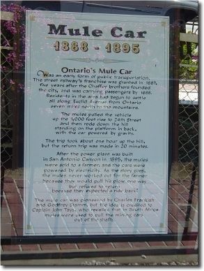
Regarding Mule Car. (Text of interpretive sign:)
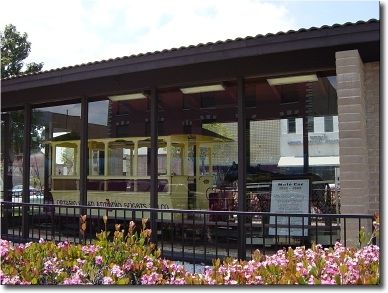
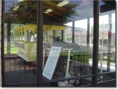
Ontario's mule car was an early form of public transportation. The Street Railway franchise was granted in 1887, 5 years after the Chaffey brothers [see George Chaffey Jr. marker] founded the city, and it was carrying passengers by 1888. Residents in the area had begun to settle all along Euclid Avenue from Ontario seven miles north to the mountains.
The mules pulled the vehicle up 1000 foot rises to 24th Street and then rode down the hill standing on the platform in the back, with the car powered by gravity.
The trip took about one hour up the hill but the return trip was made in 20 minutes.
After the power plant was built in San Antonio Canyon [see Pomona Water Power Plant marker] in 1895, the mules were sold to a farmer and the cars were powered by electricity. As the story goes, the mules never worked out for the farmer because they would pull his plow one-way but refuse to return because they expected a ride back!
The mule car was pioneered by Charles Frankish
Photographed by Joseph Beeman
3. Ontario’s Mule Car
Also see . . .
1. The Ontario & San Antonio Heights Line. Railroad's history from the Pacific Electric pages of the Electric Railway Historical Association of Southern California. (Submitted on May 23, 2006.)
2. A Shaded Trail Into the Past. 2004 article by Mark Kendall in the Los Angeles Times about Euclid Avenue, Upland, and the rich history of the area. (Submitted on May 23, 2006.)
Additional keywords. The Ontario & San Antonio Heights R.R. Co.
Photographed by Joseph Beeman
4. Ontario's Mule Car
Photographed by Joseph Beeman
5. Mule Car, 1888–1895
Photographed by Joseph Beeman
6. Ontario's Mule Car
“The Ontario & San Antonio Heights R.R. Co.”
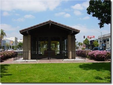
Photographed by Joseph Beeman
7. Ontario's Mule Car Exhibit
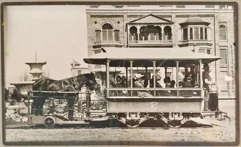
8. The Downhill Ride
Photo on display outside the historic Graber Olive House on 4th Street east of Euclid Ave.
Photographed by Joseph Beeman, April 9, 2006
9. Dedication and Restoration Tablet
Photographed by Joseph Beeman
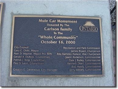
10. Donation Tablet
Photographed by Joseph Beeman
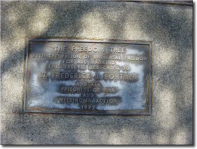
11. The Freedom Tree POW-MIA Memorial
This memorial marker is next to the exhibit. The Freedom Tree is shown in Photo No. 3. The inscription reads: With the vision of universal freedom for all mankind, this tree is dedicated to Lt. Frederick J. Fortner and all prisoners of war and missing in action. 1972.
Photographed by Joseph Beeman
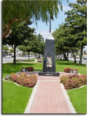
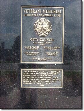
12. Veterans Memorial at the Ontario Court of Honor
The Court of Honor is on the north side of B Street, on the Euclid Ave. median, across from the Mule Car exhibit.
Photographed by Joseph Beeman
13. Memorial and Court of Honor Markers
The Veteran's Memorial obelisk was dedicated on November 8, 1998. The Ontario Court of Honor was dedicated in 1934 and its marker reads: Dedicated to those pioneers whose vision and energy established this colony, and dedicated to those who served their country at home and abroad in time of war.
Credits. This page was last revised on October 15, 2024. It was originally submitted on May 22, 2006, by Joseph Beeman of Upland, California. This page has been viewed 12,012 times since then and 261 times this year. Last updated on November 3, 2010, by Timothy Carr of Birmingham, Alabama. Photos: 1, 2, 3, 4, 5, 6, 7. submitted on May 22, 2006, by Joseph Beeman of Upland, California. 8. submitted on October 6, 2018, by Craig Baker of Sylmar, California. 9, 10, 11. submitted on May 22, 2006, by Joseph Beeman of Upland, California. 12, 13. submitted on May 23, 2006, by Joseph Beeman of Upland, California. • Syd Whittle was the editor who published this page.
