Marker Logo HMdb.org THE HISTORICAL
MARKER DATABASE
“Bite-Size Bits of Local, National, and Global History”
Honea Path in Anderson County, South Carolina — The American South (South Atlantic)
 

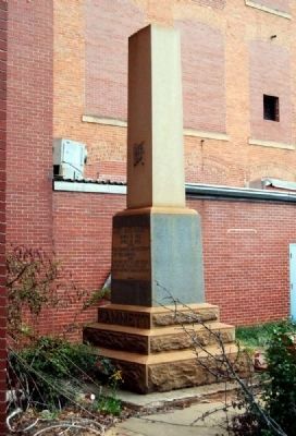
Chiquola Mill Monument


Chiquola Mill Monument Marker -<br>West Inscription image. Click for full size.
Photographed By Brian Scott, November 2, 2010
1. Chiquola Mill Monument Marker -
West Inscription
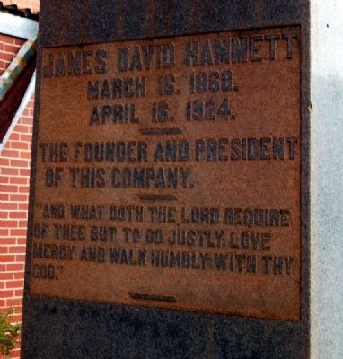
Inscription.
[West Inscription]:
James David Hammett
March 16, 1868
April 16, 1924.
-----
The founder and president
of this company.
-----
"And what doth the lord require
of thee but to do justly, love
mercy and walk humbly with thy God."
-----

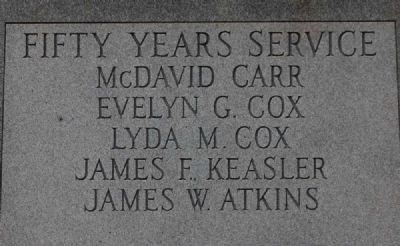
[East Inscription]:
Fifty Years Service
McDavid Carr
Evelyn G. Cox
Lyda M. Cox
James F. Keasler
James W. Atkins

 
Erected by Chiquola Mill.
 
Topics. This historical marker and monument is listed in this topic list: Industry & Commerce. A significant historical date for this entry is March 16, 1868.
 
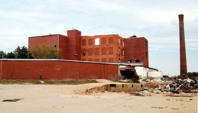
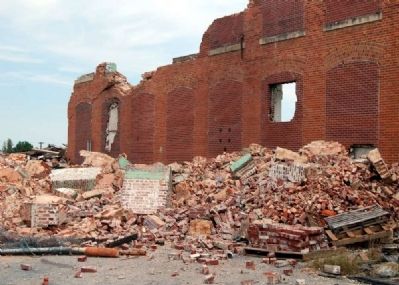
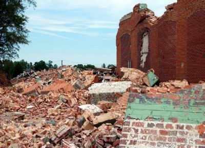
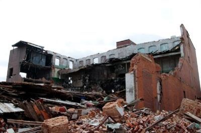
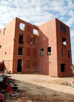
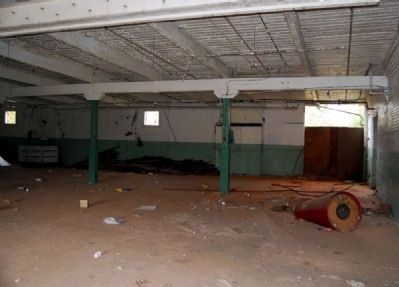
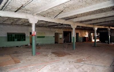
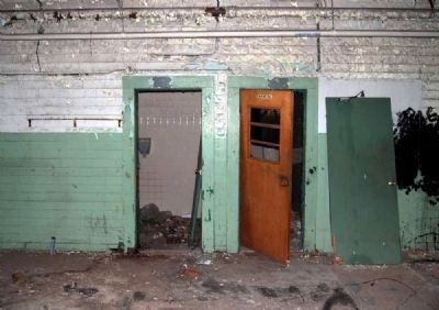
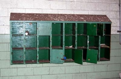
Location. 34° 27.1′ N, 82° 23.517′ W. Marker is in Honea Path, South Carolina, in Anderson County. Marker can be reached from Chiquola Avenue. Marker is located near the ruins of the mill. How long it will stand is anyone's guess as the mill is currently being demolished. Touch for map. Marker is in this post office area: Honea Path SC 29654, United States of America. Touch for directions.
 
Other nearby markers. At least 10 other markers are within 3 miles of this marker, measured as the crow flies. Carnegie Library (approx. 0.3 miles away); Honea Path (approx. 0.3 miles away); Honea Path Veterans Memorial (approx. 0.4 miles away); Panoramic Journey Through Honea Path (approx. 0.4 miles away); Chiquola Baptist Church Bell
Paid Advertisement
Click on the ad for more information.
Please report objectionable advertising to the Editor.
Click or scan to see
this page online
(approx. 0.4 miles away); The Story of the Bell (approx. 0.4 miles away); They Died for the Rights of the Working Man (approx. half a mile away); David Greer, Sr. (approx. half a mile away); Southside Baptist Church (approx. 1.8 miles away); Broadmouth Baptist Church (approx. 2.4 miles away). Touch for a list and map of all markers in Honea Path.
 
Also see . . .
1. The shooting at Chiquola Mill became known as Bloody Thursday. Appalachian History website entry (Submitted on May 28, 2023, by Larry Gertner of New York, New York.) 

2. Labor Landmark Turns into an Eyesore. Daily Reporter website entry:
All that remains of the abandoned South Carolina textile mill that was the site of the nation’s deadliest violence during a labor strike 75 years ago are crumbling brick walls, creaky wood floors and whispers of the tragedy. (Submitted on November 3, 2010, by Brian Scott of Anderson, South Carolina.) 
 
Additional commentary.
1. Honea Path
The curiously double name of Honea (Ind., path) Path, 67.6 m. (810 alt., 2,740 pop.), was adopted when as many whites as Indians frequented this section. Another version is that Honea
Chiquola Mill Monument Marker - Southwest Corner image. Click for full size.
Photographed By Brian Scott, November 2, 2010
2. Chiquola Mill Monument Marker - Southwest Corner
was the name of a family who lived there. At Honea Path in the late summer of 1934 occurred a mill riot that grew out of a Nation-wide textile strike. All South Carolina mills did not close on the zero hour, and "flying squadrons" of strikers and union sympathizers paid quick visits to mills that continued to operate. As a rule the squadrons were orderly, engaging in demonstrations to persuade the mill hands to strike; but minor injuries to their opponents kept them before the public eye. When arbitration failed, Governor Ibra C. Blackwood called out the National Guard. About 700 guardsmen were stationed in the Greenville area, and 600 citizens were deputized in Anderson to assist in preserving order. On September 6 a flying squadron visited Honea Path, to be met by a group of deputies and excited townsmen. Arguments grew into fist fights and gunplay, in which six strikers were slain and a seventh mortally wounded. At the same time a man was killed by a deputy in the Greenville area, and from Greenville and Pickens Counties came requests for the application of martial law. The governor issued a proclamation against flying squadrons, and the Honea Path Mill, for whose closing seven pickets had died on Thursday, opened the next Monday, protected by soldiers with machine guns. After the National Guard had been on duty for about a month, most of the strikers throughout the region decided
Chiquola Mill Monument Marker -<br>East Inscription image. Click for full size.
Photographed By Brian Scott, November 2, 2010
3. Chiquola Mill Monument Marker -
East Inscription
to go back to work. (Source: South Carolina: A Guide to the Palmetto State by Federal Writers Project pg 420.)
    — Submitted November 3, 2010, by Brian Scott of Anderson, South Carolina.
 
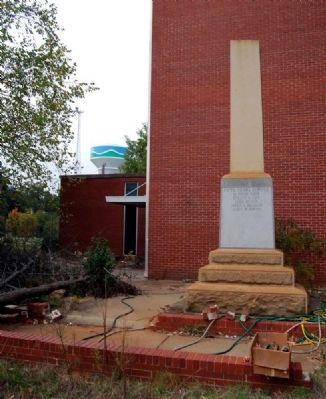
Chiquola Mill Monument Marker - East Side image. Click for full size.
Photographed By Brian Scott, November 2, 2010
4. Chiquola Mill Monument Marker - East Side
Monument Courtyard image. Click for full size.
Photographed By Brian Scott, November 2, 2010
5. Monument Courtyard
Monument Courtyard Walls image. Click for full size.
Photographed By Brian Scott, November 2, 2010
6. Monument Courtyard Walls
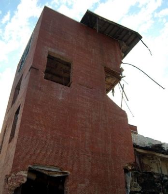
Chiquola Mill Ruins image. Click for full size.
Photographed By Brian Scott, November 2, 2010
7. Chiquola Mill Ruins
Chiquola Mill Ruins image. Click for full size.
Photographed By Brian Scott, November 2, 2010
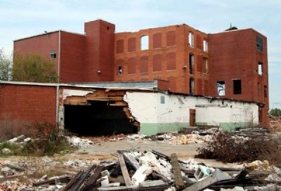
8. Chiquola Mill Ruins
Chiquola Mill -<br>South Offices image. Click for full size.
Photographed By Brian Scott, November 2, 2010
9. Chiquola Mill -
South Offices
Chiquola Mill Ruins -<br>Southwest Corner image. Click for full size.
Photographed By Brian Scott, November 2, 2010
10. Chiquola Mill Ruins -
Southwest Corner
Chiquola Mill Ruins -<br>West Wall image. Click for full size.
Photographed By Brian Scott, November 2, 2010
11. Chiquola Mill Ruins -
West Wall
Chiquola Mill Ruins -<br>West Wall image. Click for full size.
Photographed By Brian Scott, November 2, 2010
12. Chiquola Mill Ruins -
West Wall
Chiquola Mill Ruins -<br>West Wall image. Click for full size.
Photographed By Brian Scott, November 2, 2010
13. Chiquola Mill Ruins -
West Wall
Chiquola Mill Ruins -<br>Northwest Corner image. Click for full size.
Photographed By Brian Scott, November 2, 2010
14. Chiquola Mill Ruins -
Northwest Corner
Chiquola Mill Ruins -<br>North Wall image. Click for full size.
Photographed By Brian Scott, November 2, 2010
15. Chiquola Mill Ruins -
North Wall
Chiquola Mill Ruins image. Click for full size.
Photographed By Brian Scott, November 2, 2010
16. Chiquola Mill Ruins
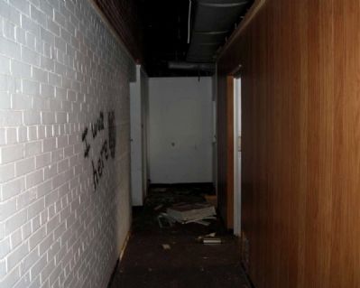
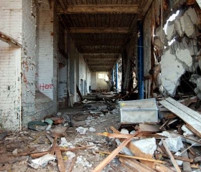
Chiquola Mill Ruins -<br>Interior Office Hallway image. Click for full size.
Photographed By Brian Scott, November 2, 2010
17. Chiquola Mill Ruins -
Interior Office Hallway
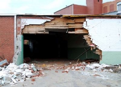
Chiquola Mill Ruins -<br>Demolished Exterior Wall image. Click for full size.
Photographed By Brian Scott, November 2, 2010
18. Chiquola Mill Ruins -
Demolished Exterior Wall
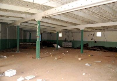
Chiquola Mill Ruins -<br>Interior image. Click for full size.
Photographed By Brian Scott, November 2, 2010
19. Chiquola Mill Ruins -
Interior
Chiquola Mill Ruins -<br>Interior image. Click for full size.
Photographed By Brian Scott, November 2, 2010
20. Chiquola Mill Ruins -
Interior
Chiquola Mill Ruins -<br>Interior image. Click for full size.
Photographed By Brian Scott, November 2, 2010
21. Chiquola Mill Ruins -
Interior
Chiquola Mill Ruins -<br>Interior Restrooms image. Click for full size.
Photographed By Brian Scott, November 2, 2010
22. Chiquola Mill Ruins -
Interior Restrooms
Chiquola Mill Ruins -<br>Interior Lockers image. Click for full size.
Photographed By Brian Scott, November 2, 2010
23. Chiquola Mill Ruins -
Interior Lockers
Chiquola Mill Ruins -<br>Interior image. Click for full size.
Photographed By Brian Scott, November 2, 2010
24. Chiquola Mill Ruins -
Interior
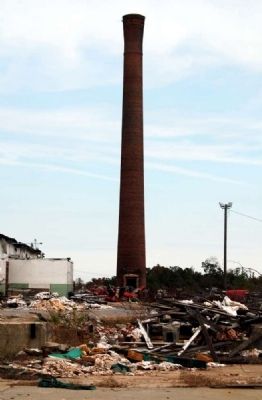
Chiquola Mill Smokestack image. Click for full size.
Photographed By Brian Scott, November 2, 2010
25. Chiquola Mill Smokestack
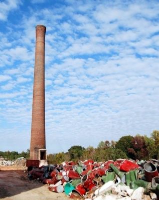
Chiquola Mill Smokestack image. Click for full size.
Photographed By Brian Scott, November 2, 2010
26. Chiquola Mill Smokestack
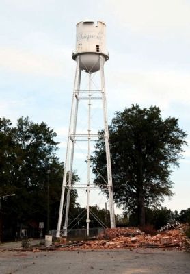
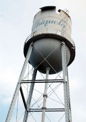
Chiquola Mill Village Water Tower image. Click for full size.
Photographed By Brian Scott, November 2, 2010
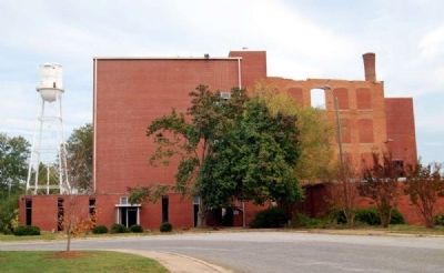
27. Chiquola Mill Village Water Tower
Chiquola Mill Village Water Tower image. Click for full size.
Photographed By Brian Scott, November 2, 2010
28. Chiquola Mill Village Water Tower
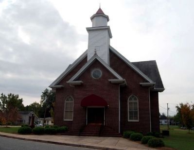
Chiquola United Methodist Church -<br>North Facade image. Click for full size.
Photographed By Brian Scott, November 2, 2010
29. Chiquola United Methodist Church -
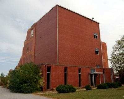
North Facade
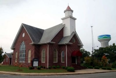
Chiquola United Methodist Church -<br>Northeast Elevation image. Click for full size.
Photographed By Brian Scott, November 2, 2010
30. Chiquola United Methodist Church -
Northeast Elevation
 
 
Credits. This page was last revised on May 28, 2023. It was originally submitted on November 3, 2010, by Brian Scott of Anderson, South Carolina. This page has been viewed 1,752 times since then and 93 times this year. Photos:   1, 2, 3, 4, 5, 6, 7, 8, 9, 10, 11, 12, 13, 14. submitted on November 3, 2010, by Brian Scott of Anderson, South Carolina.   15, 16. submitted on November 4, 2010, by Brian Scott of Anderson, South Carolina.   17, 18, 19, 20. submitted on November 3, 2010, by Brian Scott of Anderson, South Carolina.   21, 22, 23, 24. submitted on November 4, 2010, by Brian Scott of Anderson, South Carolina.   25. submitted on November 3, 2010, by Brian Scott of Anderson, South Carolina.   26. submitted on November 4, 2010, by Brian Scott of Anderson, South Carolina.   27, 28, 29, 30. submitted on November 3, 2010, by Brian Scott of Anderson, South Carolina.
Share this page.  
Share on Tumblr
m=37530

CeraNet Cloud Computing sponsors the Historical Marker Database.
This website earns income from purchases you make after using our links to Amazon.com. We appreciate your support.
Paid Advertisement
Apr. 24, 2024