Near Swanton in Garrett County, Maryland — The American Northeast (Mid-Atlantic)
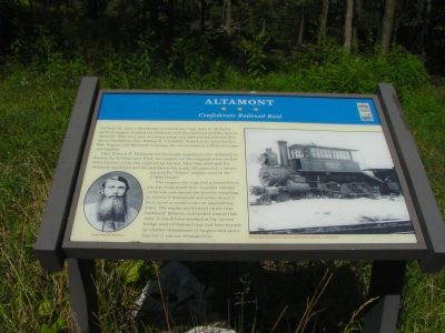
Altamont
Confederate Railroad Raid
On April 26, 1863, a detachment of Confederate Capt. John H. McNeill’s partisan rangers attacked the Baltimore and Ohio Railroad facilities here at Altamont. They were part of a larger group that entered Oakland that Sunday as Confederate Gen. William E. “Grumble” Jones led an incursion into West Virginia and Maryland to hamper the rail movements of Federal troops and supplies.
Capt. Edward H. McDonald led the ranger detachment into Altamont to destroy the facilities here. First, the rangers cut the telegraph wires so that other stations on the line could not be warned. Then they destroyed the switching machinery and the switches in the track (Altamont was a switching area for “helper” engines used on the 17-Mile Grade).
The rangers also captured a locomotive at the top of the grade here. A soldier climbed in the cab and opened the throttle, intending to reverse it downgrade and either wreck it on a curve or crash it into an approaching train. The engine ran forward rather than backward, however, and headed towards Oakland. It would have wrecked at the burned bridge west of Oakland that had been burned by another detachment of rangers that morning, but it ran out of steam first.
Erected by Maryland Civil War Trails.
Topics and series. This historical marker is listed in these topic lists: Railroads & Streetcars • War, US Civil. In addition, it is included in the Baltimore and Ohio Railroad (B&O), and the Maryland Civil War Trails series lists. A significant historical month for this entry is April 1859.
Location. 39° 25.677′ N, 79° 16.78′ W. Marker is near Swanton, Maryland, in Garrett County. Marker is on Maryland Highway (Maryland Route 135) west of Altamont Road, on the left when traveling east. Touch for map. Marker is at or near this postal address: 7935 Maryland Hwy, Swanton MD 21561, United States of America. Touch for directions.
Other nearby markers. At least 8 other markers are within 6 miles of this marker, measured as the crow flies. Cleveland Cottage (approx. 2.8 miles away); Deer Park Hotel (approx. 2.8 miles away); James Cardinal Gibbons (approx. 2.8 miles away); Cleveland Cottage and Site of Deer Park Hotel (approx. 3.1 miles away); Garrett County Road Workers' Strike (approx. 5 miles away); Remembering Sept. 10, 1959 (approx. 5½ miles away); B&O Railroad Station (approx. 5½ miles away); Garrett County's Honored War Dead (approx. 5.7 miles away).

Photographed By J. J. Prats, August 13, 2006
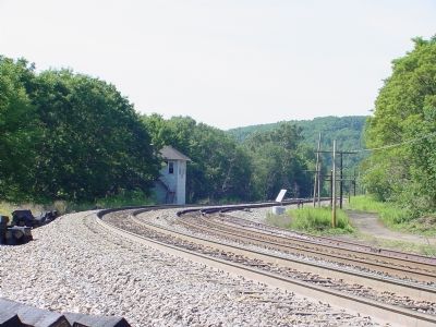
4. The Tracks at Altamont, Looking East
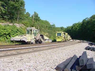
It's all downhill from here. 17 Mile Grade begins here. It is the steepest railroad grade on the east coast; more than 2.5% in places. And plenty of curves. Dozens of trains have wrecked going down this grade, some recently. The track repairing equipment is parked on the siding used to hold helper engines that have just finished helping a train uphill.
Credits. This page was last revised on June 11, 2022. It was originally submitted on August 16, 2006, by J. J. Prats of Powell, Ohio. This page has been viewed 2,690 times since then and 49 times this year. Last updated on November 4, 2010, by Timothy Carr of Birmingham, Alabama. Photos: 1, 2, 3, 4. submitted on August 16, 2006, by J. J. Prats of Powell, Ohio. • Craig Swain was the editor who published this page.


