Near Baraboo in Sauk County, Wisconsin — The American Midwest (Great Lakes)
Devil's Lake and the Local Residents
Inscription.
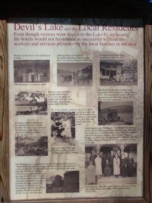
Even though visitors were drawn to the Lake by its beauty, the hotels would not have been as successful without the workers and the services provided by the local families in the area.
Caption for upper left photo: Workers at the hotels were often local women. Ella Marquardt pictured in center.
Caption for upper middle photo: Although they worked hard throughout the busy tourist season, there was always time for a little fun.
Caption for upper right photo: Kirkland employees doing laundry near the Pavilion.
Caption for middle left photo: Before the road was built, renting a boat from a livery was the quickest way to get from the west to the east shore on the south end of the lake.
Caption for center photo: The Pierce family would get up at four in the morning to mix and fry 30 dozen donuts to deliver to campers by 6 AM. Pies and bread were also made. Sisters Dorothy (left) and Elsie Pierce selling milk and baked goods to a camper.
Caption for middle right photo: The Devil's Lake area would change noticeably when it became a State Park in 1911. The automobile would make an appearance and the hotels would slowly fade from the landscape.
Caption for lower left photo: Camping would predominate throughout the warm summer months. Tourists could choose a location anywhere along the shoreline and stay at Devil's Lake for free!
Caption for lower middle photo: The Martin Farm was located at the top of what is now known as "Snake Hill", the steep winding road that leads to the southwest corner of the lake. Family lore is that the road follows the same path that the Martin children created to take farm produce to the early Devil's Lake visitors. The Martin Family descendants made this interpretive display possible through a generous donation. It is dedicated to their family and the other local families that have worked at Devil's Lake over the years.
Caption for lower right photo: Local families like the Martin's would provide services to the tourists that ranged from working at the hotels on the south shore, to renting boats and selling farm produce and ice to early campers and resorters. Augusta Martin, a widow, was the mother of ten children. Family members often depended on income earned by working at the lake. l. to r. Ladina, Edward, Alma, August, Augusta, Albert, Ida, Louis, Emma and Mary. (John not pictured.) Circa 1926.
Erected by the Martin Family descendants.
Topics. This historical marker is listed in this topic list: Entertainment. A significant historical year for this entry is 1911.
Location. 43°
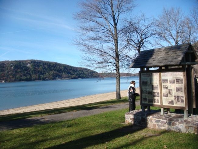
24.549′ N, 89° 43.62′ W. Marker is near Baraboo, Wisconsin, in Sauk County. Marker can be reached from South Lake Road, 3 miles west of Wisconsin Highway 113, on the right when traveling west. The marker is in the South Shore area of Devil's Lake State Park (an entrance fee is required). Touch for map. Marker is in this post office area: Baraboo WI 53913, United States of America. Touch for directions.
Other nearby markers. At least 8 other markers are within walking distance of this marker. Early History of Devil's Lake (here, next to this marker); North Shore Hotel Era (here, next to this marker); South Shore Hotel Era (here, next to this marker); Ice Age National Scientific Reserve (about 400 feet away, measured in a direct line); Camp Life (approx. 0.8 miles away); Building a Nation (approx. 0.8 miles away); Building a Park System (approx. 0.8 miles away); Hard at Work (approx. 0.8 miles away). Touch for a list and map of all markers in Baraboo.
Credits. This page was last revised on June 16, 2016. It was originally submitted on November 7, 2010, by William J. Toman of Green Lake, Wisconsin. This page has been viewed 752 times since then and 16 times this year. Photos: 1, 2. submitted on November 7, 2010, by William J. Toman of Green Lake, Wisconsin. • Syd Whittle was the editor who published this page.

