Mount Pleasant in Charleston County, South Carolina — The American South (South Atlantic)
Pierates Cruze
⎯⎯⎯
Pierates Cruze Gardens
1. Pierates Cruze
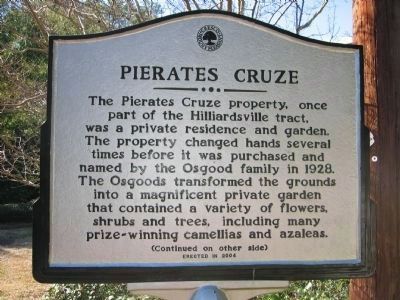
Pierates Cruze
The Pierates Cruze property, once part of the Hilliardsville tract, was a private residence and garden. The property changed hands several times before it was purchased and named by the Osgood family in 1928. The Osgoods transformed the grounds into a magnificent private garden that contained a variety of flowers, shrubs and trees, including many prize-winning camellias and azaleas.
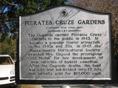
Pierates Cruze Gardens
The Osgoods opened Pierates Cruze Gardens to the public in 1943. It became a popular tourist attraction in the 1940s and 50s. In 1947, the Massachusetts Horticultural Society awarded Mrs. Osgood the prestigious “Gold Medal” for her development of new varieties of hybrid camellias. After the Osgood’s deaths, the land was sold and subdivided into 13 lots that initially sold for $10,000 each.
Erected 2004.
Topics. This historical marker is listed in these topic lists: Horticulture & Forestry • Settlements & Settlers. A significant historical year for this entry is 1928.
Location. 32° 46.734′ N, 79° 52.168′ W. Marker is in Mount Pleasant, South Carolina, in Charleston County. It is on Pierates
this page online

Regionally, this marker is in the Lowcountry. It is also in the American South, specifically in the Deep South, and on the Eastern Seaboard. Globally, it is in the North Atlantic Region, North America, the Western Hemisphere, the Western World, and the Anglosphere. Historically, it finds itself in what was once the territory of the Mississippian Culture, one of the original Thirteen Colonies, one of the Confederate States of America, and the Antebellum South.
Other nearby markers. At least 8 other markers are within walking distance of this marker: Alhambra Hall (about 300 feet away, measured in a direct line); Mount Pleasant Academy (approx. 0.4 miles away); Edmund Jenkins / Ocean Grove Cemetery (approx. 0.4 miles away); The Old Village (approx. 0.4 miles away); Ronkin's Long Room / Ferry Service (approx. 0.4 miles away); Patjens Post Office (approx. half a mile away); "Storm of the Century" (approx. half a mile away); Confederate Cemetery / Memorial (approx. half a mile away). Touch for a list and map
2. Pierates Cruze Gardens
October 6, 2010
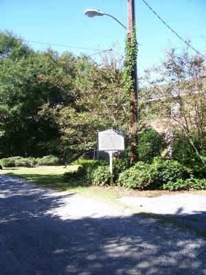
3. Pierates Cruze Marker
Credits. This page was last revised on June 16, 2016. It was originally submitted on November 11, 2010. This page has been viewed 781 times since then and 26 times this year. Photos: 1, 2, 3. submitted on November 11, 2010. • Bill Pfingsten was the editor who published this page.
