Mount Pleasant in Charleston County, South Carolina — The American South (South Atlantic)
Point Plantation / Richmond Plantation
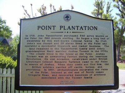
Point Plantation
In 1715, John Vanderhorst purchased 540 acres known as the Point for ₤360. So began a long line of ownership by this well-known Colonial family. By 1740, Johnís son Joseph and 29 slaves lived at the Point and operated a successful livestock and timber business. The land remained in the Vanderhorst family until Johnís granddaughter Mary married Joshua Toomer in the 1770s. The couple lived in the house at the Point. Joshua Toomer was an unwavering Patriot during the American Revolution. On one occasion, cavalrymen under British Lieutenant Colonel Banastre Tarleton came to the Point in search of Joshua. When they could not find him, the British soldiers carried off cattle, horses, and provisions. In 1997, archaeologists excavated the ruins of the Point, located at the end of North James Gregarie Road, and recovered hundreds of artifacts associated with the Toomer family.
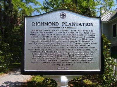
Richmond Plantation
Richmond Plantation on Toomer Creek was owned by William Vanderhorst. After the death of his first wife Mary, Joshua Toomer married Williamís daughter Sabina in 1784. Together, they acquired Richmond Plantation which they combined with the Point. In 1796, the property passed to their son Anthony V. Toomer, a wealthy physician and planter. A. V. Toomer owned other Christ Church Parish plantations and
Erected 2009.
Topics. This historical marker is listed in these topic lists: Colonial Era • Settlements & Settlers. A significant historical year for this entry is 1715.
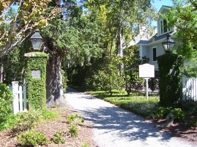
Location. 32° 54.264′ N, 79° 47.598′ W. Marker is in Mount Pleasant, South Carolina, in Charleston County. Marker is at the intersection of Henniretta Hartford Road and Gray Marsh Road on Henniretta Hartford Road. Touch for map. Marker is in this post office area: Mount Pleasant SC 29466, United States of America. Touch for directions.
Other nearby markers. At least 8 other markers are within 5 miles of this marker, measured as the crow flies. Wando Pottery (approx. 1.6 miles away); Phillips Community (approx. 1.8 miles away); Thomas Lynch at Rivertowne (approx. 2.6 miles away); Brickyard Plantation (approx. 3.4 miles away); Sweetgrass Baskets (approx. 3Ĺ miles away); Shell Rings and Shell Middens (approx. 3.6 miles away); Boone Hall Plantation (approx. 4.2 miles away); Confederate Lines (approx. 4.3 miles away). Touch for a list and map of all markers in Mount Pleasant.
Credits. This page was last revised on June 16, 2016. It was originally submitted on November 11, 2010. This page has been viewed 1,186 times since then and 63 times this year. Photos: 1, 2, 3. submitted on November 11, 2010. • Bill Pfingsten was the editor who published this page.


