"Storm of the Century"
Side A
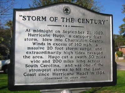
At midnight on September 21, 1989, Hurricane Hugo, a category four storm, blew into Charleston County. Winds in excess of 140 mph, a massive 20 foot storm surge, and extraordinarily high tides ravaged the area. Hugo cut a swath 50 miles wide and 200 miles long across South Carolina, and was one of the strongest storms to hit the East Coast since Hurricane Hazel in 1954.
Side B
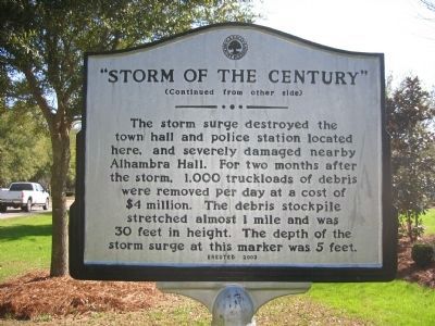
The storm’s 6 foot surge destroyed the town hall/police station located here, and severely damaged nearby Alhambra Hall. After the storm 1,000 truck loads of debris were removed per day at a cost of $4 million for the 2 month cleanup. The debris stockpile stretched almost 1 mile and was 30 feet in height. The depth of the storm surge at this marker was 5 feet.
Erected 2003 by Town of Mount Pleasant.
Topics. This historical marker is listed in this topic list: Disasters. A significant historical month for this entry is September 1828.
Location. 32° 47.114′ N, 79° 52.351′ W. Marker is in Mount Pleasant, South Carolina, in Charleston County. Marker is on Royall Avenue close to Bank Street. Touch for map. Marker is in this post office area: Mount Pleasant SC 29464, United States of America. Touch for directions.
Other nearby markers. At least 8 other markers are within walking distance of this marker. The Old Village (about 300 feet away, measured in a direct line); Ronkin's Long Room / Ferry Service
Additional keywords. Hurricane
Credits. This page was last revised on June 16, 2016. It was originally submitted on November 11, 2010. This page has been viewed 1,201 times since then and 33 times this year. Photos: 1, 2, 3. submitted on November 11, 2010. 4. submitted on January 3, 2011, by Mike Stroud of Bluffton, South Carolina. • Bill Pfingsten was the editor who published this page.


