Near Portage in Wood County, Ohio — The American Midwest (Great Lakes)
Portage Stockade
Ohio Revolutionary Memorial Trail
Portage Stockade
»»««
Built in 1812, by General
Hull, to protect one of his
camps on his march from
Dayton to Detroit.
Garrisoned again in 1813,
by order of General Harrison.
Erected 1930 by Ohio Revolutionary Memorial Commission. (Marker Number C.)
Topics and series. This historical marker is listed in these topic lists: Forts and Castles • War of 1812. In addition, it is included in the Ohio Revolutionary Memorial Commission series list.
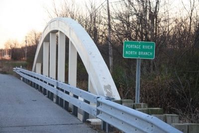
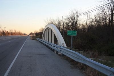
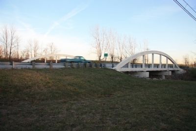
Location. Marker is missing. It was located near 41° 19.274′ N, 83° 39.037′ W. Marker was near Portage, Ohio, in Wood County. Marker was on Dixie Highway South (Ohio Route 25) south of Main Street, on the right when traveling south. This historical marker was located on the west side of the highway next to the bridge crossing the Portage River (of which there are several). According to both of the Portage Lion Club articles (see related links), the site of this historical marker was just south of the town of Portage, Ohio, on the West Branch of the Portage River. Today, although there are several bridges along the Dixie Highway South that cross different branches of the Portage River, none of them are labeled as being the West Branch of the Portage River (rather they are labeled North, Middle, and South Branches). However, because the articles state in one instance that the marker is "along the west side of route 25, just south of Portage", and in another instance that the marker is "about a mile south of the present village of Portage" (and the North Branch is about a mile from the center of town), and because the official Wood County history states that there was "a small stockade on the north branch of the Portage, called Fort Portage," I am going with the marker having been located on the west side of the North Branch bridge. Touch for map. Marker was in this post office area: Portage OH 43451, United States of America. Touch for directions.
Other nearby markers. At least 8 other markers are within 3 miles of this location, measured as the crow flies. Enright Park Veterans Memorial (about 600 feet away, measured in a direct line); WWII Honor Roll Portage Corp & Rural Rte (approx. 0.4 miles away); Portage Cemetery Veterans Memorial (approx. 0.9 miles away); Wood County Home Cemetery (approx. 2.6 miles away); Cattle Barn, 1892 (approx. 2.6 miles away); Corn Crib & Tool Shed, 1872 (approx. 2.6 miles away); Cisterns, Ponds, and Privies
(approx. 2.7 miles away); Chicken Coop, Wash House, and Wood Shed, 1873 (approx. 2.7 miles away). Touch for a list and map of all markers in Portage.
More about this marker. In the 1980s I picked up a publication entitled, "Brief History of Wood County, Ohio." With regards to the Portage Stockade and General Hull's march on Detroit through Wood County it states the following: "About the middle of June, 1812, this little settlement was set astir by the arrival of General William Hull with two thousand troups on his way to Detroit. He had come up from Dayton and in order to guard their line of communications had constructed Fort McArthur in Harding County. Findlay on the Blanchard River, a small stockade on the north branch of the Portage, called Fort Portage. These were but temporary defenses and were garrisoned by a few men under petty officers.
The route over which they came was Wood County's pioneer road from north to south and was such miserable excuse for a road that the early settlers called it "Hull Trace."....The army trail entered now Wood County south of North Baltimore, continued north through the eastern section of that present little city, ran just west of now Cygnet, and from the Portage blockhouse veered
east, ran north through Bowling Green near the western edge of the Bowling Green State University grounds and crossed the Maumee River about two miles south of Maumee City.
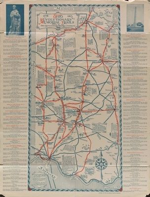
All of that being said, this particular historical marker is part of the Ohio Revolutionary Memorial Trail series (type C) which was put in place in 1930 to celebrate the 150th anniversary of the Ohio's Revolutionary War era Battle of Piqua, by the Ohio Revolutionary Memorial Commission.
In order to accomplish this, in 1929 the state of Ohio created the Ohio Revolutionary Memorial Commission, and then in 1930 this commission created 22 military trails, throughout western Ohio, between Cincinnati, Ohio on the state's southern border and Toledo, Ohio on the state's northern border. Each of these military trails represented the routes, or trails, used by military leaders during either the Revolutionary War, the Indian Wars of 1790 to 1795, or the War of 1812. Each of these military routes connected various related historical sites, that were marked with Ohio Revolutionary Memorial Commission (type C) markers, along each of the military trails.
The routes of these military trails were in turn marked by type A and type B Ohio Revolutionary Memorial Commission markers that served as directional (type B) and distance (type A) markers.
Originally, back in 1930, there were erected
70 some of these Ohio Revolutionary Memorial Commission, type C, markers. To date, there are only 20 some of them that have been located and posted on the Historical Marker database. A number of them are presently missing, and presumed to be permanently lost.
Regarding Portage Stockade. Years ago when I was a young child (late 1950s - early 1960s) my parents would drive me from our home in Toledo, Ohio to my grandmother's home in Findlay, OH. Because these were the days before Interstate 75 had been constructed, we would drive there on State Route 25, which would take us through Portage, Ohio.
After we passed through Portage we would cross the headwaters of the Portage River, and as we did, I would see a historical marker, beside the bridge, that always intrigued me. Well, many years have passed since I last saw this historical marker and I had all but forgotten about this marker until I was researching markers that were erected by the Ohio Revolutionary Memorial Commission, back in 1930, that I stumble across proof that this distant memory had actually truly existed.
I discovered that the marker indicated the location of a military post that had been part of Hull's Military Trail, during the War of 1812. In attempting to do more research on this topic I discovered two related links that were provided by the Portage
Loins Club. In addition to the historical background information shared in the articles, the author also shared his memories of this marker which were remarkably similar to my own.
He stated, "Like me, you may remember seeing a historical marker along the west side of route 25, just south of Portage. The marker had a brass plaque that told about the fort and its location. It was there when I was in grade school, but the sign, like the fort itself, is no longer in sight."
Related markers. Click here for a list of markers that are related to this marker. To better understand the relationship, study each marker in the order shown.
Also see . . .
1. Fort Portage, A Historical Fort In Wood County That Has Long Since Disappeared. This is a link to information provided by the Portage Lions Club. (Submitted on November 12, 2010, by Dale K. Benington of Toledo, Ohio.)
2. Portage Stockade. This is a link to more information provided by the Portage Lions Club. (Submitted on November 12, 2010, by Dale K. Benington of Toledo, Ohio.)
3. Ohio Revolutionary Memorial Trail System. A description of the Revolutionary Memorial Trail System developed by the state of Ohio in 1929 - 1930. (Submitted on November 13, 2010, by Dale K. Benington of Toledo, Ohio.)
4. Hull's Road. This is a link to information provided by Ohio History Central, an online encyclopedia
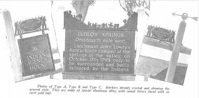
Photographed By Ohio Revolutionary Memorial Commission
6. Ohio Revolutionary Memorial Commission Marker Types
View of the three types of markers used by the Ohio Revolutionary Memorial Commission. The marker on the left is a type A marker, the marker in the middle is a type C (just like our missing marker), and the marker on the right is a type B.
5. Salmagundi: The Portage Blockhouse. This is a link to an article written about the Portage Blockhouse. (Submitted on March 26, 2016, by Dale K. Benington of Toledo, Ohio.)
Credits. This page was last revised on July 25, 2022. It was originally submitted on November 12, 2010, by Dale K. Benington of Toledo, Ohio. This page has been viewed 1,678 times since then and 66 times this year. Photos: 1, 2, 3, 4. submitted on November 12, 2010, by Dale K. Benington of Toledo, Ohio. 5. submitted on September 2, 2014, by Dale K. Benington of Toledo, Ohio. 6. submitted on April 20, 2016, by Dale K. Benington of Toledo, Ohio.

