Poughkeepsie in Dutchess County, New York — The American Northeast (Mid-Atlantic)
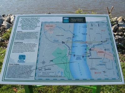
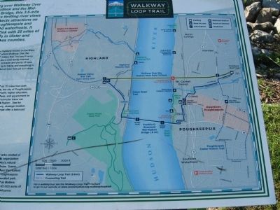
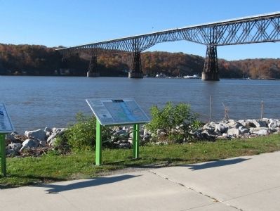
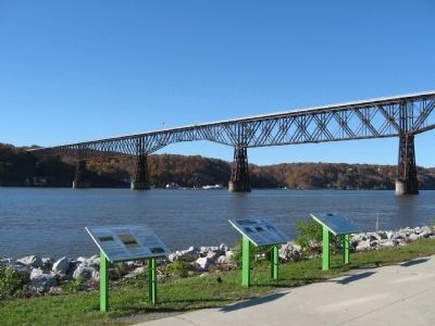
Walkway Loop Trail
Highland
Located in Ulster County, Highland resides on the west bank of the Hudson River where Walkway Over the Hudson meets the Hudson Valley Rail Trail and Franny Reese State Park. It provides a rural, family-oriented community featuring apple orchards and plenty of open space. From waterfront dining to hiking and everything in between, Highland offers a small-town feel, yet is in close proximity to everything.
Poughkeepsie
Nestled on the Hudson River, just 70 miles from both midtown Manhattan and Albany, the City of Poughkeepsie is the center of the arts, entertainment, higher education, health care, transportation, business and government for Dutchess County. Metro-North commuter trains run hourly to and from Grand Central Station. See for yourself how natural beauty, history, strategic location and plenty of forward-thinking people offer a balanced lifestyle and a sense of place.
Scenic Hudson
Franny Reese State Park is one of 40 parks created or enhanced by Scenic Hudson, the largest organization dedicated to preserving the Hudson Valley's natural treasures and making them public resources. Scenic Hudson's leadership grant to Walkway Over the Hudson served as a catalyst in transforming the Poughkeepsie Railroad Bridge into the world's longest elevated park. Today it's engaged in Saving the Land That Matters Most, a collaborative campaign to protect 65,000 acres of the highest scenic, ecological and agricultural significance.
Topics. This historical marker is listed in this topic list: Man-Made Features.
Location. 41° 42.478′ N, 73° 56.419′ W. Marker is in Poughkeepsie, New York, in Dutchess County. Marker is at the intersection of Main Street and North Water Street, on the right when traveling west on Main Street. Located in Waryas Memorial Park on the Hudson River. Touch for map. Marker is in this post office area: Poughkeepsie NY 12601, United States of America. Touch for directions.
Other nearby markers. At least 8 other markers are within walking distance of this marker. Walkway Over the Hudson (here, next to this marker); The Queen City of the Hudson (here, next to this marker); River That Flows Both Ways (about 600 feet away, measured in a direct line); Poughkeepsie Waterfront (about 600 feet away); Victor C. Waryas Memorial Park (about 700 feet away); Franklin D. Roosevelt Mid-Hudson Bridge
(approx. 0.2 miles away); Lange Rack (approx. 0.2 miles away); The Hudson River Day Line (approx. 0.2 miles away). Touch for a list and map of all markers in Poughkeepsie.
Also see . . . Walkway Loop Trail. Scenic Hudson website entry (Submitted on November 12, 2010, by Michael Herrick of Southbury, Connecticut.)
Credits. This page was last revised on April 21, 2021. It was originally submitted on November 12, 2010, by Michael Herrick of Southbury, Connecticut. This page has been viewed 831 times since then and 13 times this year. Photos: 1, 2, 3, 4. submitted on November 12, 2010, by Michael Herrick of Southbury, Connecticut.


