Near Annandale in Fairfax County, Virginia — The American South (Mid-Atlantic)
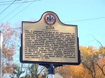
Ilda
Erected 2009 by The Fairfax County History Commission.
Topics and series. This historical marker is listed in this topic list: African Americans. In addition, it is included in the Virginia, Fairfax County History Commission series list. A significant historical year for this entry is 2008.
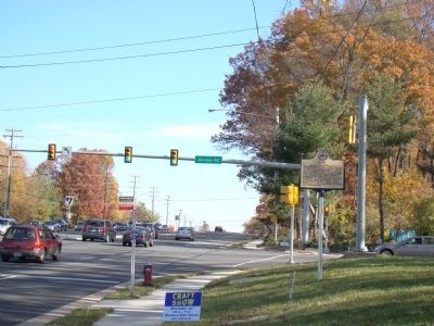
Location. 38° 50.3′ N, 77° 15.1′ W. Marker is near Annandale, Virginia, in Fairfax County. Marker is at the intersection of Little River Turnpike (Virginia Route 236) and Guinea Road, on the left when traveling west on Little River Turnpike. Touch for map. Marker is in this post office area: Annandale VA 22003, United States of America. Touch for directions.
Other nearby markers. At least 8 other markers are within 2 miles of this marker, measured as the crow flies. The Guinea Road Cemetery Reinterment (approx. ¾ mile away); Gooding's Tavern (approx. 0.8 miles away); Burke’s Station Raid (approx. 0.9 miles away); The Pines (approx. 1.6 miles away); Washington & Old Dominion Railroad Regional Park (approx. 1.9 miles away); City of Fairfax Community Services and Recreation (approx. 1.9 miles away); Northern Virginia Regional Park Authority (approx. 1.9 miles away); Bog Wallow Ambush (approx. 2 miles away). Touch for a list and map of all markers in Annandale.
Related marker. Click here for another marker that is related to this marker.
Credits. This page was last revised on June 16, 2016. It was originally submitted on November 13, 2010, by J. J. Prats of Powell, Ohio. This page has been viewed 3,941 times since then and 535 times this year. Photos: 1, 2. submitted on November 13, 2010, by J. J. Prats of Powell, Ohio.

