Florence in Florence County, South Carolina — The American South (South Atlantic)
Wilson School
⎯⎯⎯
Wilson High School
Photographed by Cindy Bullard, November 8, 2010
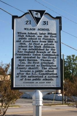
1. Wilson School Marker
Wilson School. Wilson School, later Wilson High School, was the first public school in Florence, and stood here from 1866 to 1906. At first a private school for black children, it was established by the New England Branch of the Freedmen’s Union Commission and operated by the Freedmen’s Bureau. Thomas C. Cox, its first principal, later served as Darlington County sheriff. The school became a public school after the S.C. Constitution of 1868 authorized a system of free public schools.
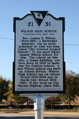
Wilson High School. Rev. Joshua E. Wilson (1844-1915), a Methodist minister, was an early principal of what was long called “the Colored Graded School.” It was most likely named Wilson School for him. The school on this site, a frame building, was torn down in 1906 to make was for Central School. A new Wilson School was built on Athens Street. Wilson High School was on Athens Street 1906-1956 and on North Irby Street 1956-1982. It has been on Old Marion Highway since 1982.
Erected 2010 by South Carolina State Historic Preservation Office; sponsored by the Wilson High School Alumni Association, Inc. (Marker Number 21-31.)
Topics and series. This historical marker is listed in these topic lists: African Americans • Education. In addition, it is included in the South Carolina Historical Markers series list. A significant historical year for this entry is 1866.
Location. 34° 11.613′ N, 79° 45.957′ W. Marker is in Florence, South Carolina, in Florence County. It is on E. Palmetto St. (U.S. 76) close to S. Dargan Street, on the left when traveling east. Touch for map. Marker is in this post office area: Florence SC 29501, United States of America. Touch for directions.

Regionally, this marker is in the Pee Dee. It is also in the American South and specifically in the Deep South. Globally, it is in North America,
this page online
Other nearby markers. At least 8 other markers are within walking distance of this marker: F.H. McLeod House (a few steps from this marker); Downtown Arts Corridor (about 700 feet away, measured in a direct line); Florence Civic Improvement Society Memorial (approx. 0.2 miles away); McLeod Medical Center (approx. 0.2 miles away); Propellers, CSS Peedee (approx. 0.2 miles away); Swept yards (approx. 0.2 miles away); The Lorax: Unless (approx. 0.2 miles away); Bell, Florence City Hall (approx. 0.2 miles away). Touch for a list and map of all markers in Florence.
Photographed by Cindy Bullard, November 8, 2010
2. Wilson High School Marker
Photographed by Cindy Bullard, November 10, 2010
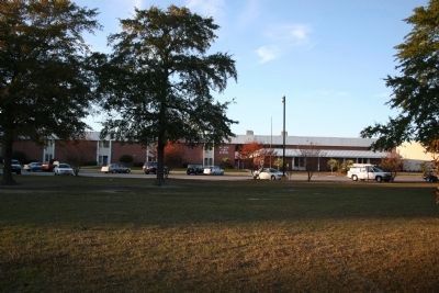
3. Wilson High School
The high school is on East Old Marion Highway, SE of the intersection of E. McIver Rd. and E. Ashby Rd.
Credits. This page was last revised on January 19, 2026. It was originally submitted on November 16, 2010, by David Bullard of Seneca, South Carolina. This page has been viewed 3,148 times since then and 143 times this year. Photos: 1, 2, 3. submitted on November 16, 2010, by David Bullard of Seneca, South Carolina. • Bill Pfingsten was the editor who published this page.
