Bristow in Marlboro County, South Carolina — The American South (South Atlantic)
Barnabas Kelet Henagan Home Site
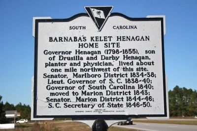
Photographed by Cindy Bullard, November 11, 2010
1. Barnabas Kelet Henagan Home Site Marker
Erected 1974 by Marlboro County Historic Preservation Commission. (Marker Number 35-19.)
Topics. This historical marker is listed in this topic list: Government & Politics. A significant historical year for this entry is 1840.
Location. 34° 25.178′ N, 79° 37.108′ W. Marker is in Bristow, South Carolina, in Marlboro County. It is on State Highway 38 close to Arcadia Road, on the left when traveling north. Touch for map. Marker is in this post office area: Blenheim SC 29516, United States of America. Touch for directions.

Regionally, this marker is in South Carolina’s Pee Dee. It is also in the American South and specifically in the Deep South. Globally, it is in North America, the Western Hemisphere, the Western World, and the Anglosphere. Historically, it finds itself in
this page online
Other nearby markers. At least 8 other markers are within 8 miles of this marker, measured as the crow flies: Frederick Charles Hans Bruno Poellnitz / Ragtown (approx. 0.2 miles away); Grave of Mason Lee / Will of Mason Lee (approx. 0.4 miles away); Brownsville Baptist Church (approx. 1.6 miles away); Brownsville Church (approx. 1.9 miles away); Blenheim (approx. 6.6 miles away); Robert Blair Campbell / John Campbell (approx. 6.6 miles away); Blenheim Mineral Springs (approx. 7 miles away); Joel Allen House (approx. 7.2 miles away).
Another marker is no longer nearby. Reedy Creek Springs (was approx. 3.7 miles away but has been confirmed missing).
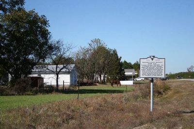
Photographed by Cindy Bullard, November 11, 2010
2. Marker as seen from Acadia Rd.
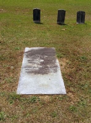
Photographed by Paul Crumlish, May 7, 2010
3. Grave of Barnabas Kelet Henagan
In the Rogers Cemetery (the old Brownsville Church cemetery), near the community of Bristow.
Credits. This page was last revised on September 18, 2020. It was originally submitted on November 16, 2010, by David Bullard of Seneca, South Carolina. This page has been viewed 1,449 times since then and 41 times this year. Photos: 1, 2. submitted on November 16, 2010, by David Bullard of Seneca, South Carolina. 3. submitted on November 26, 2010, by PaulwC3 of Northern, Virginia. • Bill Pfingsten was the editor who published this page.
