Mount Pleasant in Charleston County, South Carolina — The American South (South Atlantic)
Mount Pleasant Waterworks
November 16, 2010
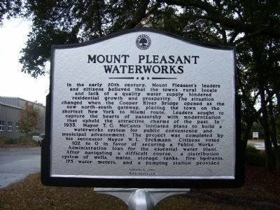
1. Mount Pleasant Waterworks Marker - Side A
Side A
In the early 20th century, Mount Pleasant’s leaders and citizens believed that the town’s rural locale and lack of a quality water supply hindered residential growth and prosperity. The situation changed when the Cooper River Bridge opened as the new north-south gateway, placing the town on the shortest New York to Miami route. Leaders sought to capture the hearts of passersby with modernization that upheld the attractive charms of the past. In 1933, Mayor T. G. McCants initiated plans to build a waterworks system for public convenience and municipal advancement. The project was completed by his successor Mayor W. L. Erckmann. Citizens voted 102 to 0 in favor of securing a Public Works Administration loan for the essential water plant. After navigating a difficult course, a distribution system of wells, mains, storage tanks, fire hydrants, 175 water meters and a pumping station provided
Side B
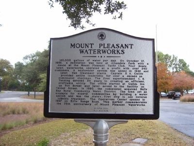
160,000 gallons of water per day. On October 17, 1935, a dedication was held at Alhambra Park with a dance at the Mount Pleasant Yacht Club. Four years later, waterworks operated at a profit with over 240 customers. A wastewater
this page online
Erected 2010 by Town of Mount Pleasant.
Topics. This historical marker is listed in this topic list: Industry & Commerce. A significant historical month for this entry is October 1881.
Location. 32° 48.639′ N, 79° 49.949′ W. Marker is in Mount Pleasant, South Carolina, in Charleston County. It can be reached from Rifle Range Road close to Royston Road. Touch for map. Marker is in this post office area: Mount Pleasant SC 29464, United States of
November 16, 2010
2. Mount Pleasant Waterworks Marker - Side B

Regionally, this marker is in the Lowcountry. It is also in the American South, specifically in the Deep South, and on the Eastern Seaboard. Globally, it is in the North Atlantic Region, North America, the Western Hemisphere, the Western World, and the Anglosphere. Historically, it finds itself in what was once the territory of the Mississippian Culture, one of the original Thirteen Colonies, one of the Confederate States of America, and the Antebellum South.
Other nearby markers. At least 8 other markers are within 3 miles of this marker, measured as the crow flies: Seaside (approx. 1.1 miles away); Veterans Memorial (approx. 1.7 miles away); Rifle Range Road (approx. 1.8 miles away); Vaughn Edward Kee (approx. 2 miles away); Greenhill Community / Greenhill Farming (approx. 2.1 miles away); Defending the Inland Waterways (approx. 2.1 miles away); The Christ Church Lines (approx. 2.2 miles away); Fort Palmetto (approx. 2.2 miles away). Touch for a list and map of all markers in Mount Pleasant.
November 16, 2010
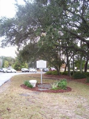
3. Mount Pleasant Waterworks Marker
Credits. This page was last revised on June 16, 2016. It was originally submitted on November 16, 2010. This page has been viewed 762 times since then and 24 times this year. Photos: 1, 2, 3. submitted on November 16, 2010. • Bill Pfingsten was the editor who published this page.
