Central El Paso in El Paso County, Texas — The American South (West South Central)
The Mormon Plot in Concordia Cemetery
Photographed by Steve Gustafson, June 15, 2008
1. The Mormon Plot in Concordia Cemetery Marker
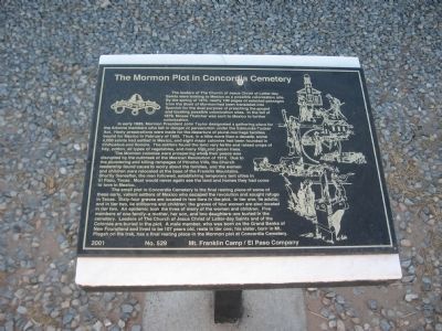
In early 1885, Mormon President John Taylor designated a gathering place for Arizona members who felt in danger of persecution under the Edmunds-Tucker Act. Hasty preparations were made for the departure of plural-marriage families bound for Mexico in February of 1885. Thus, in a little more than a decade, some 4,000 saints had settled in Mexico, and eight major colonies had been founded in Chihuahua and Sonora. The settlers found the land very fertile and raised crops of hay, cotton, all types of vegetables, and many fruit and pecan trees.
The Mormon colonies were prospering when their peace was disrupted by the outbreak of the Mexican Revolution of 1910. Due to the plundering and killing rampages of Pancho Villa, the
this page online
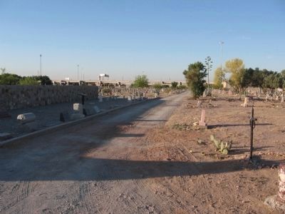
The small plot in Concordia Cemetery is the final resting place of some of these early, valiant settlers in Mexico who escaped the revolution and sought refuge in Texas. Sixty-four graves are located in two tiers in the plot. In tier one, lie adults: and in tier two, lie stillborns and children. Five members of one family - a mother, her son, and two daughters - are buried in the cemetery. Leaders of The Church of Jesus Christ of Latter-Day Saints and of the Colonies are buried in the plot. A male member, who was born on the Grand Banks of Newfoundland and lived to be 107 years old, rests in tier one: his sister, born in Mt. Pisgah on the trek, has a final resting place in the Mormon plot at Concordia Cemetery.
Erected 2001 by Daughers of Utah Pioneers - Mt Franklin Camp / El Paso Company. (Marker Number 529.)
Topics and series.
Photographed by Steve Gustafson, June 15, 2008
2. The Mormon Plot in Concordia Cemetery Marker
Location. 31° 46.831′ N, 106° 26.841′ W. Marker is in El Paso, Texas, in El Paso County. It is in Central El Paso. It can be reached from the intersection of Yandell Drive and North Stevens Street. Marker and Mormon Plot are located inside the Concordia Cemetery. Touch for map. Marker is at or near this postal address: 3700 Yandell Dr, El Paso TX 79903, United States of America. Touch for directions.

Regionally, this marker is in Texas’ Trans-Pecos & Big Bend Region. It is also in the American Borderlands and in the Southwest. Globally, it is in North America, a Gulf of Mexico state, the Western Hemisphere, the Western World, and the Anglosphere. Historically, it finds itself in what was once New Spain, the Republic of Texas, and one of the Confederate States of America.
Other nearby markers. At least 8 other markers are within walking distance of this marker: John Wesley Hardin (within shouting distance of this marker); Concordia Cemetery (about 400 feet away, measured in a direct line); Fort Bliss Buffalo Soldiers Memorial (about 600 feet away); James H. White (about 600 feet away); Site of Camp Concordia and Fort Bliss (approx. 0.4 miles away); Henry O. Flipper (approx. half a mile away); Dr. Lawrence A. Nixon (approx. half a mile away); Henry C. Trost (approx. half a mile away). Touch for a list and map of all markers in El Paso.
Credits. This page was last revised on June 16, 2016. It was originally submitted on January 28, 2010, by Steve Gustafson of Lufkin, Texas. This page has been viewed 1,941 times since then and 55 times this year. Last updated on November 16, 2010, by Bill Kirchner of Tucson, Arizona. Photos: 1, 2. submitted on January 28, 2010, by Steve Gustafson of Lufkin, Texas. • Syd Whittle was the editor who published this page.
