Near Mechanicsville in Darlington County, South Carolina — The American South (South Atlantic)
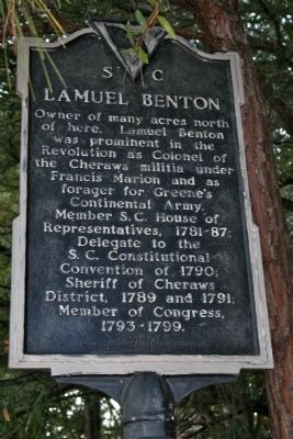
Lamuel Benton
Erected 1968 by Darlington County Historical Commission. (Marker Number 16-5.)
Topics. This historical marker is listed in these topic lists: Government & Politics • War, US Revolutionary. A significant historical year for this entry is 1790.
Location. 34° 21.155′ N, 79° 44.58′ W. Marker is near Mechanicsville, South Carolina, in Darlington County. Marker is on Cashua Ferry Rd. (State Highway 34) close to Georgetown Road, on the left when traveling east. Marker is in the edge of the tree line near the intersection of Georgetown Rd. Touch for map. Marker is in this post office area: Darlington SC 29532, United States of America. Touch for directions.
Other nearby markers. At least 8 other markers are within 6 miles of this marker, measured as the crow flies. Mount Pleasant Baptist Church / Lowther's Hill Cemetery (about 600 feet away, measured in a direct line); Evan Pugh (approx. 2.4 miles away); Pleasant Grove Church (approx. 4.8 miles away); Mont Clare Community Center (approx. 5.2 miles away); Roseville Plantation Slave And Freedman's Cemetery / Clarke Cemetery (approx. 5.4 miles away); Ney School / Back Swamp School (approx. 5.6 miles away); Roseville Plantation (approx. 5.7 miles away); John Westfield Lide House (approx. 6 miles away).
Credits. This page was last revised on November 15, 2020. It was originally submitted on November 17, 2010, by David Bullard of Seneca, South Carolina. This page has been viewed 575 times since then and 11 times this year. Photo 1. submitted on November 17, 2010, by David Bullard of Seneca, South Carolina. • Bill Pfingsten was the editor who published this page.
