Las Cruces in Doņa Ana County, New Mexico — The American Mountains (Southwest)
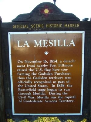
La Mesilla
Topics and series. This historical marker is listed in this topic list: War, US Civil. In addition, it is included in the Butterfield Overland Mail, and the El Camino Real de Tierra Adentro series lists. A significant historical month for this entry is November 1846.
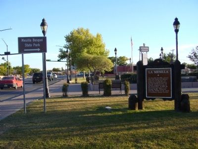
Location. 32° 16.661′ N, 106° 47.766′ W. Marker is in Las Cruces, New Mexico, in Doņa Ana County. Marker is at the intersection of State Road 28 and State Road 292, on the right when traveling south on State Road 28. Touch for map. Marker is in this post office area: Las Cruces NM 88005, United States of America. Touch for directions.
Other nearby markers. At least 8 other markers are within walking distance of this marker. Butterfield Overland Trail (approx. ž mile away); a different marker also named La Mesilla (approx. ž mile away); Billy the Kid (approx. ž mile away); Civil War Battle of Mesilla & Major Lynde's Retreat (approx. ž mile away); Plaza de Mesilla (approx. ž mile away); All Servicemen and Women (approx. ž mile away); Head Quarters, Dept. of New Mexico (approx. ž mile away); The Gadsden Purchase Celebration (approx. ž mile away).
Credits. This page was last revised on June 16, 2016. It was originally submitted on November 18, 2010, by Bill Kirchner of Tucson, Arizona. This page has been viewed 1,183 times since then and 56 times this year. Photos: 1, 2, 3. submitted on November 18, 2010, by Bill Kirchner of Tucson, Arizona. • Craig Swain was the editor who published this page.


