Bayard in Grant County, New Mexico — The American Mountains (Southwest)
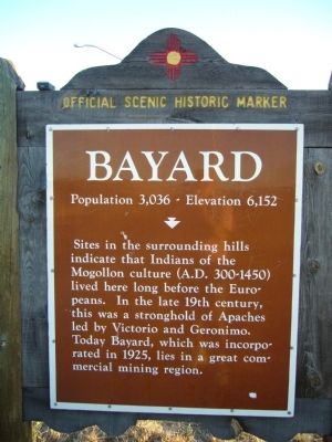
Bayard
Population 3,036 - Elevation 6,152
Topics. This historical marker is listed in these topic lists: Settlements & Settlers • Wars, US Indian. A significant historical year for this entry is 1925.
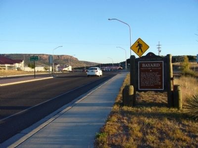
Location. 32° 45.633′ N, 108° 8.717′ W. Marker is in Bayard, New Mexico, in Grant County. Marker is on U.S. 180 at milepost 122.2, on the left when traveling north. Touch for map. Marker is in this post office area: Bayard NM 88023, United States of America. Touch for directions.
Other nearby markers. At least 8 other markers are within 6 miles of this marker, measured as the crow flies. Santa Rita Copper Mines (approx. 1˝ miles away); a different marker also named Bayard (approx. 1˝ miles away); Fort Bayard - 1866-1900 (approx. 1.6 miles away); Fort Bayard (approx. 2.1 miles away); Ladies Auxiliary of Local 890 (approx. 3.2 miles away); Kneeling Nun (approx. 3.2 miles away); Reclaiming the Land (approx. 5.3 miles away); Modern Mining & Processing (approx. 5.3 miles away). Touch for a list and map of all markers in Bayard.
Credits. This page was last revised on June 16, 2016. It was originally submitted on November 19, 2010, by Bill Kirchner of Tucson, Arizona. This page has been viewed 878 times since then and 68 times this year. Photos: 1, 2, 3. submitted on November 19, 2010, by Bill Kirchner of Tucson, Arizona. • Craig Swain was the editor who published this page.


