Near Pinos Altos in Grant County, New Mexico — The American Mountains (Southwest)
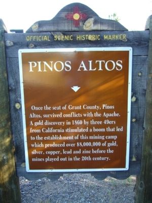
Pinos Altos
Topics. This historical marker is listed in these topic lists: Industry & Commerce • Wars, US Indian. A significant historical year for this entry is 1860.
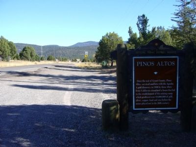
Location. 32° 51.533′ N, 108° 13.367′ W. Marker is near Pinos Altos, New Mexico, in Grant County. Marker is on State Road 15 at milepost 6.2, on the right when traveling north. Touch for map. Marker is in this post office area: Pinos Altos NM 88053, United States of America. Touch for directions.
Other nearby markers. At least 8 other markers are within 7 miles of this marker, measured as the crow flies. Old Silver City Cemetery (approx. 5˝ miles away); GFWC Silver City Women's Club (approx. 6 miles away); Silver City Water Works (approx. 6.2 miles away); Fort Bayard (approx. 6.2 miles away); Silver City (approx. 6˝ miles away); Fort Bayard - 1866-1900 (approx. 6.7 miles away); Changing Values (approx. 6.8 miles away); Santa Rita Copper Mines (approx. 6.8 miles away).
Credits. This page was last revised on June 16, 2016. It was originally submitted on November 20, 2010, by Bill Kirchner of Tucson, Arizona. This page has been viewed 893 times since then and 43 times this year. Photos: 1, 2, 3. submitted on November 20, 2010, by Bill Kirchner of Tucson, Arizona. • Craig Swain was the editor who published this page.


