Marker Logo HMdb.org THE HISTORICAL
MARKER DATABASE
“Bite-Size Bits of Local, National, and Global History”
Mount Pleasant in Charleston County, South Carolina — The American South (South Atlantic)
 

Confederate Lines


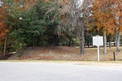
Confederate Lines Marker image. Click for full size.
Photographed By Mike Stroud, November 21, 2010
1. Confederate Lines Marker
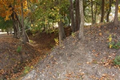
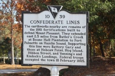
Inscription. The earthworks nearby are remains of the 1861 fortifications built to defend Mount Pleasant. They extended east 2.5 miles from Butler’s Creek at Boone Hall Plantation to Fort Palmetto on Hamlin Sound. Supporting this line were Battery Gary and those at Hobcaw Point, Hog Island, Hibben Street, and Venning’s and Kinloch’s Landings. Federal troops occupied the town 18 February 1865.
 
Erected 2003 by The Christ Church Parish Preservation Society. (Marker Number 10-39.)
 
Topics. This historical marker is listed in this topic list: War, US Civil. A significant historical date for this entry is February 18, 1865.
 
Location. 32° 50.687′ N, 79° 48.778′ W. Marker is in Mount Pleasant, South Carolina, in Charleston County. Marker is on Old Georgetown Road (State Highway 10-1808), on the right when traveling east. Located 20 yards east of US 17, north of Long Point Road. Touch for map. Marker is in this post office area: Mount Pleasant SC 29466, United States of America. Touch for directions.
 
Other nearby markers. At least 8 other markers are within walking distance of this marker. Snee Farm (about 300 feet away, measured in a direct line); Christ Church (about 400 feet away); a different marker also named Christ Church (about 400 feet away); Boone Hall Plantation (approx. ¼ mile away); Charles Pinckney (approx. 0.6 miles away); a different
Paid Advertisement
Click on the ad for more information.
Please report objectionable advertising to the Editor.
Click or scan to see
this page online
marker also named Charles Pinckney (approx. 0.6 miles away); Archeology (approx. 0.7 miles away); a different marker also named Snee Farm (approx. 0.7 miles away). Touch for a list and map of all markers in Mount Pleasant.
 
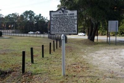
Confederate Lines Marker seen along Old Georgetown Road...US 17 in background image. Click for full size.
Photographed By Mike Stroud, November 21, 2010
2. Confederate Lines Marker seen along Old Georgetown Road...US 17 in background
Confederate Lines Marker and remaining earthworks image. Click for full size.
Photographed By Mike Stroud, November 21, 2010
3. Confederate Lines Marker and remaining earthworks
Confederate Lines Earthworks, as mentioned image. Click for full size.
Photographed By Mike Stroud, November 21, 2010
4. Confederate Lines Earthworks, as mentioned
 
 
Credits. This page was last revised on June 16, 2016. It was originally submitted on November 21, 2010, by Mike Stroud of Bluffton, South Carolina. This page has been viewed 1,306 times since then and 66 times this year. Photos:   1, 2, 3, 4. submitted on November 21, 2010, by Mike Stroud of Bluffton, South Carolina. • Craig Swain was the editor who published this page.
Share this page.  
Share on Tumblr
m=38263

CeraNet Cloud Computing sponsors the Historical Marker Database.
This website earns income from purchases you make after using our links to Amazon.com. We appreciate your support.
Paid Advertisement
May. 5, 2024