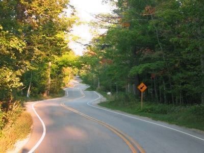
Near Gills Rock in Door County, Wisconsin — The American Midwest (Great Lakes)
Pilot Island Site
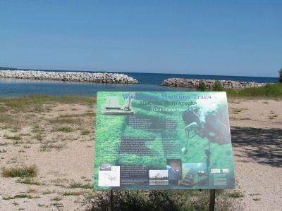
Historic Shipwrecks
— Wisconsin's Maritime Trails —
J.E. Gilmore · Type: wooden schooner · Built: 1867, Asa Wilcox, · Three Mile Bay, N.Y. · Length: 137.7' · Beam: 25.4' · Propulsion: sail, 2 masted.
Forest · Type: wooden scow-schooner · Built: 1857, David Lester, · Newport, Mich. / rebuilt 1880 · Length: 87.5' / rebuilt 115.6' · Beam: 22.25' / rebuilt 23' · Propulsion: sail, 2 masted / rebuilt 3 masted.
A.P. Nichols · Type: wooden schooner · Built: 1861, Bailey Brothers, · Madison Dock, Ohio · Length: 145' · Beam: 30' · Propulsion: sail, 3 masted.
Listed on the National Register of Historic Places in 1992
Depth: 20 ~ 50'
Location: NW side of Pilot Island, a seasonal mooring buoy marks the site.
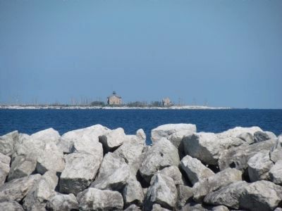
On the night of Oct. 28, 1891, the Forest entered Death's Door en route from Chicago to Nahma, Mich. A gale struck and drove the schooner onto the reef at Pilot Island. The next day, the crew of five rowed to shore and took refuge at the lighthouse. The following fall the dangerous passage wrecked two more ships at the same spot. On Oct. 17, the Gilmore, sailing from Chicago to Elk Rapids, Mich., entered the passage in heavy, shifting winds and was blown onto the reef. The crew waited out the storm on board. On Oct. 28, fierce winds and blinding snow struck the Nichols on its way from Chicago to Escanaba, Mich. The storm tore apart the Nichols' rigging and drove her onto the rocks near the Gilmore and Forest. In a daring rescue, the lighthouse crew helped the sailors leap from the rolling Nichols onto the icy deck of the Forest to reach Pilot Island.
The wrath of Death's Door battered the three stranded schooners for several years, scattering pieces in all directions. The tangled wreckage now allows divers to visit three victims of Death's Door in a single dive.
Through the Maritime Trails, the Wisconsin Historical Society and Wisconsin Sea Grant are working with local communities to preserve our maritime heritage. To learn more, visit www.maririmetrails.org.
Erected 2002 by the Wisconsin Historical Society's Maritime Preservation and Archaeology Program.
Topics and series. This historical marker is listed in this topic list: Waterways & Vessels. In addition, it is included in the Wisconsin’s Maritime Trails series list. A significant historical year for this entry is 1867.
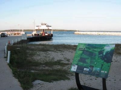
Location. 45° 17.423′ N, 86° 58.654′ W. Marker is near Gills Rock, Wisconsin, in Door County. Marker is on State Highway 42 east of South Port des Morts Drive, on the right
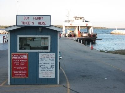
when traveling east. Marker is at the Northport Ferry Terminal of the Washington Island Ferry. Touch for map. Marker is at or near this postal address: 215 Highway 42, Ellison Bay WI 54210, United States of America. Touch for directions.
Other nearby markers. At least 8 other markers are within 3 miles of this marker, measured as the crow flies. Town of Liberty Grove (approx. 0.6 miles away); The Niagara Escarpment (approx. 0.6 miles away); Ancient Shorelines (approx. 0.6 miles away); The Skipper (approx. 2.1 miles away); The Fishtug Skipper (approx. 2.1 miles away); Rudder from the "City of Glasgow" (approx. 2.1 miles away); Air Funnel (approx. 2.1 miles away); Anchor (approx. 2.1 miles away). Touch for a list and map of all markers in Gills Rock.
More about this marker. This is a Wisconsin's Maritime Trails marker.
Also see . . . Pilot Island Site. Wisconsin Shipwrecks website entry (Submitted on March 9, 2024, by Larry Gertner of New York, New York.)
Credits. This page was last revised on March 9, 2024. It was originally submitted on November 23, 2010, by Keith L of Wisconsin Rapids, Wisconsin. This page has been viewed 1,043 times since then and 33 times this year. Photos: 1, 2. submitted on November 23, 2010, by Keith L of Wisconsin Rapids, Wisconsin. 3, 4. submitted on July 21, 2012, by Bob (peach) Weber of Dewey, Arizona. 5. submitted on November 23, 2010, by Keith L of Wisconsin Rapids, Wisconsin. 6. submitted on July 21, 2012, by Bob (peach) Weber of Dewey, Arizona. 7. submitted on November 23, 2010, by Keith L of Wisconsin Rapids, Wisconsin.

