Portland in Multnomah County, Oregon — The American West (Northwest)
Vanport
Oregon History

Photographed By Paul Crumlish, August 2, 2010
1. Vanport Marker
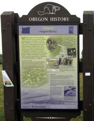
Captions: (top center) Henry Kaiser highlighted above.; (upper right) A groundbreaking 24-hour daycare program, the largest in the world, cared for preschoolers and older children and cooked hot take-home meals for parents returning from the shipyard. School classes and faculty for Vanports's 9,000 children were racially integrated. Schools ran seven days a week.; (lower right) Dikes surrounding Vanport presumably would protect it from flooding, but an old railroad cut that had been filled in as part of the dike on the western edge of Vanport unexpectedly gave way. (bottom strip) After the war, pioneering aspects of Vanport’s child and health care programs remained popular examples of what a private enterprise and the government could achieve when united in a common purpose -- “an experiment in the full socialization of life.”
The Very First of its Kind
Vanport soon became Oregon's second largest city. Nicknamed Kaiserville, most Vanporters lived in one-bedroom apartments. There was a library, post-office, police station, infirmary, public cafeteria, stores, and a 750-seat movie theater. While most Americans had no medical insurance, Kaiser's workers enjoyed a prepaid health plan. After the war, the plan and its doctors became the Kaiser Permanente medical and dental care program.
Swept Away
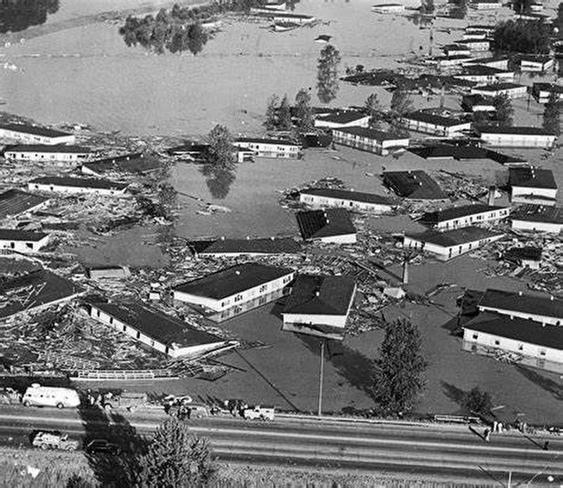
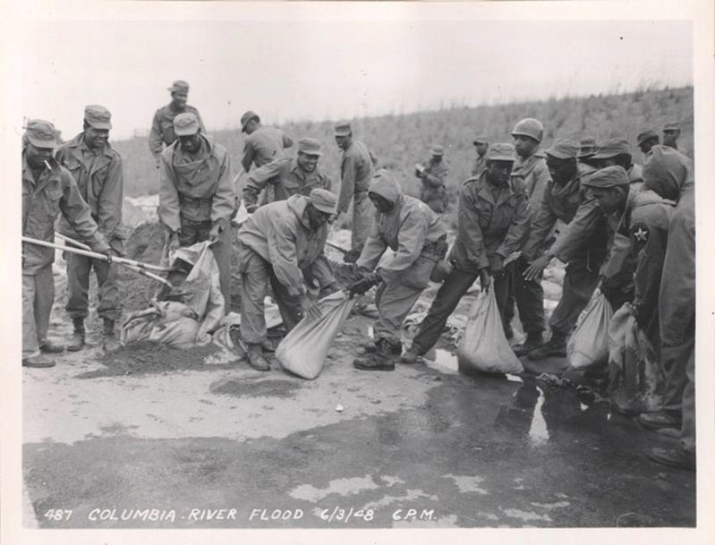
In 1948 at 4:17pm on Memorial Day, a portion of the dike surrounding Vanport was broken. The Columbia River swollen with early spring snowmelt flowed quickly into Vanport. Floodwaters 15 feet deep quickly washed Vanport away.
Residents had been assured by authorities that the dikes were holding and that they would be warned in ample time to evacuate. The break caught everyone, including the authorities, by surprise. Thankfully, sloughs within Vanport absorbed the initial surge, allowing approximately 40 minutes for most people to flee Vanport to higher ground along Denver Avenue. Still, 18 people lost their lives in the flood.
With an overwhelming number of displaced people, private citizens took many Vanporters into their homes. Bitterness over the lack of proper warning by the authorities resulted in court cases. Ultimately, the courts decided the Federal government could not be held responsible for a natural disaster.
Erected 2009 by Oregon Travel Information Council.
Topics and series. This historical marker is listed in these topic lists: Industry & Commerce • Native Americans • War, World II. In addition, it is included in the Oregon Beaver Boards series list. A significant historical year for this entry is 1942.
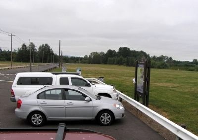
Location. 45° 35.881′ N, 122° 41.182′ W. Marker is in Portland, Oregon, in Multnomah County. Marker is on North Broadacre Road, 0.1 miles west of North Expo Road. The marker is located at the parking area for the West Delta Park dog park. It is opposite the main entrance to Portland International Raceway. Touch for map. Marker is at or near this postal address: 1809 N Broadacre Rd, Portland OR 97217, United States of America. Touch for directions.
Other nearby markers. At least 8 other markers are within 2 miles of
this marker, measured as the crow flies. Heart of a Trading Empire (approx. 1.7 miles away in Washington); A Busy Place Is This (approx. 1.7 miles away in Washington); United States Army Arrives (approx. 1.7 miles away in Washington); Captain George Vancouver Monument Plaza (approx. 1.8 miles away in Washington); Captain George Vancouver Monument (approx. 1.8 miles away in Washington); A River of Settlers (approx. 1.8 miles away in Washington); Ilchee (approx. 2 miles away in Washington); Esther Short (approx. 2 miles away in Washington).
Also see . . .
1. The Untold Story Of This Oregon City That Vanished Overnight. "Only in Your State" entry (Submitted on January 25, 2021, by Larry Gertner of New York, New York.)
2. Vanport. "Oregon Travel Experience" entry (Submitted on January 12, 2018, by Douglass Halvorsen of Klamath Falls, Oregon.)
3. Vanport. "Oregon Travel Experience" Audio Tour (Submitted on November 25, 2010, by PaulwC3 of Northern, Virginia.)
Credits. This page was last revised on March 14, 2021. It was originally submitted on November 25, 2010, by PaulwC3 of Northern, Virginia. This page has been viewed 5,260 times since then and 57 times this year. Photos: 1, 2. submitted on November 25, 2010, by PaulwC3 of Northern, Virginia. 3. submitted on January 25, 2021, by Larry Gertner of New York, New York. 4. submitted on February 11, 2018.


