Savannah Beach in Lewes in Sussex County, Delaware — The American Northeast (Mid-Atlantic)
Lighthouses
Lewes Maritime History Trail
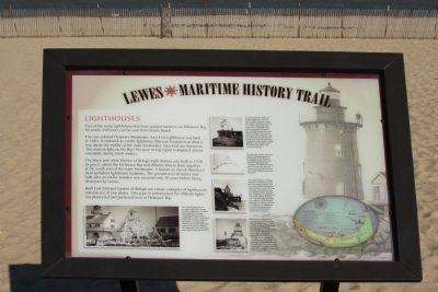
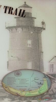
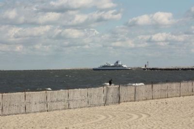
Two of the many lighthouses that have guided mariners on Delaware Bay for nearly 250 years can be seen from Lewes beach.
The rust-colored Delaware Breakwater East End Lighthouse was built in 1885. It replaced an earlier lighthouse that was located near what is now the middle of the inner breakwater. East End was known as " the noisiest light on the Bay" because its fog signal trumpeted almost constantly during harsh winters.
The black-and-white Harbor of Refuge Light Station was built in 1926. Its perch, where the Delaware Bay and Atlantic Ocean slam together at the south end of the outer breakwater, isknown as one of America's most turbulent lighthouse locations. The present iron structure was built after an earlier wooden one survived only 20 years before being destroyed by storms.
Erected by City of Lewes. (Marker Number 6.)
Topics and series. This historical marker is listed in these topic lists: Communications • Waterways & Vessels. In addition, it is included in the Lighthouses series list. A significant historical year for this entry is 1885.
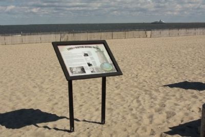
Location. 38° 46.901′ N, 75° 7.823′ W. Marker is in Lewes, Delaware, in Sussex County. It is in Savannah Beach. Marker is on Bayview Avenue. Located between Virginia Avenue and East Savannah Road, on the beach. Touch for map. Marker is in this post office area: Lewes DE 19958, United States of America. Touch for directions.
Other nearby markers. At least 8 other markers are within walking distance of this marker. Menhaden Fisheries (here, next to this marker); Lewes Station (approx. 0.3 miles away); Lewes Railroad Swing Bridge (approx. 0.3 miles away); The Fort Miles Connection (approx. 0.3 miles away); The Historic Lewes Canal Railroad Swing Bridge (approx. 0.3 miles away); Mayor Otis Smith (approx. 0.4 miles away); Lewes-Rehoboth Canal (approx. 0.6 miles away); Unknown Sailors' Cemetery (approx. 0.6 miles away). Touch for a list and map of all markers in Lewes.
Regarding Lighthouses. Marker Photos from the collection of the Delaware River and Bay Lighthouse Foundation and the National Archives
Also see . . . Delaware Lighthouses. Lighthouse Friends entry. (Submitted on September 21, 2020, by Larry Gertner of New York, New York.)
Photographed By Lighthouses Marker
2. Lighthouses Marker, lower left picture
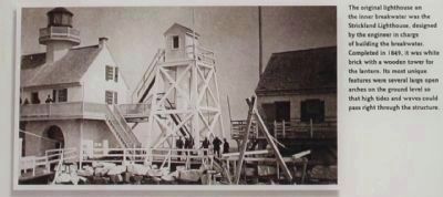
The original lighthouse on the inner breakwater was the Strickland Lighthouse, designed by the engineer incharge of building the breakwater. Completed in 1849, it was white brick with a wooden tower for the latern. Its most unique features were several large open arches on the ground level so that high tides and waves could pass right through the structure.
Photographed By Lighthouses Marker
4. Lighthouses Marker
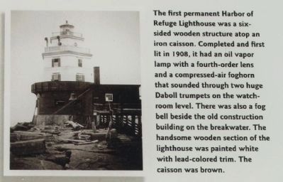
The first permanent Harbor of Refuge Lighthouse was a six-sided wooden structure atop an iron caisson. Completed and first lit in 1908, it had an oil vapor lamp with a fourth-order lens and a compressed-air foghorn that sounded through two huge Daboll
trumpets on the watchroom level. There was also a fog bell beside the old construction building on the breakwater. The handsome wooden section of the lighthouse was painted white with lead-colored trim. The caisson was brown.
Photographed By Lighthouses Marker
5. Lighthouses Marker
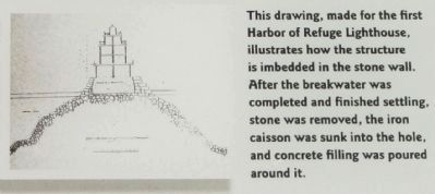
This drawing, made for the first Harbor of Refuge Lighthouse,
illustrates how the structure is imbedded in the stone wall.
After the breakwater was completed and finished settling,
stone was removed, the iron caisson was sunk into the hole,
and concrete filling was poured around it.
Photographed By Lighthouses Marker
6. Lighthouses Marker
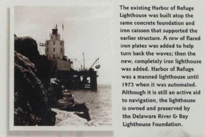
The existing Harbor of Refuge Lighthouse was built atop the
same concrete foundation and iron caisson that supported
the earlier structure. A row of flared iron plates was added to
help turn back the waves; then the new, completely iron
lighthouse was added. Harbor of Refuge was a manned
lighthouse until 1973 when it was automated. Although it is still
an active aid to navigation, the lighthouse is owned and
preserved by the Delaware River & Bay Lighthouse Foundation.
Photographed By Lighthouses Marker
7. Lighthouses Marker
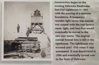
Construction began on the existing Delaware Breakwater East
End Lighthouse in 1885 with the pouring of a concrete foundation. A temporary wooden light tower was erected
and topped with the iron lantern room, light, and lens that would eventually be moved to the new iron tower. The original conical
Fresnel lens is still in the lighthouse. The lighthouse was manned until 1950 when it was automated. It was deactivated in
1996 and eventually turned over to the State of Delaware.
Credits. This page was last revised on September 18, 2023. It was originally submitted on November 29, 2010, by Mike Stroud of Bluffton, South Carolina. This page has been viewed 877 times since then and 18 times this year. Photos: 1, 2, 3, 4, 5, 6, 7, 8, 9. submitted on November 29, 2010, by Mike Stroud of Bluffton, South Carolina.
