Near Brooklet in Bulloch County, Georgia — The American South (South Atlantic)
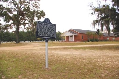
Upper Black Creek Church
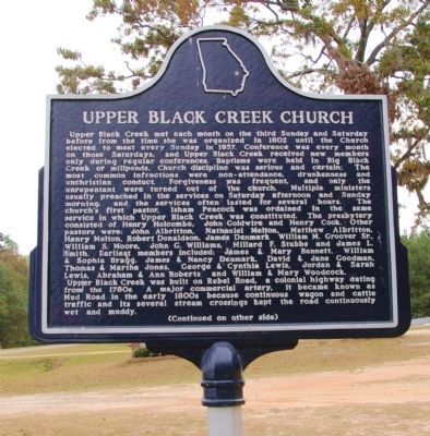
Upper Black Creek met each month on the third Sunday and Saturday before from the time she was organized in 1802 until the Church elected to meet every Sunday in 1957. Conference was every month on those Saturdays, and Upper Black Creek received new members only during regular conferences. Baptisms were held in Big Black Creek or millponds. Church discipline was serious and certain; The most common infractions were non-attendance, drunkenness and unchristian conduct. Forgiveness was frequent, and only the unrepentant were turned out of the church. Multiple ministers usually preached in the services on Saturday afternoon and Sunday morning, and services often lasted for several hours. The church’s first pastor, Isham Peacock was ordained in the same service in which Upper Black Creek was constituted. The presbytery consisted of Henry Hocombe, John Goldwire and Henry Cook. Other pastors were: John Albritton, Nathaniel Melton, Matthew Abritton, Henry Melton, Robert Donaldson, James Denmark William M. Groover Sr., William S. Moore, John G. Williams, Millard F. Stubbs and James L. Smith. Earliest members included: James & Mary Bennett, William & Sophia Bragg, James & Nancy Denmark, David & Jane Goodman, Thomas & Martha Jones, George & Cynthia Lewis, Jordan & Sarah Lewis, Abraham & Ann Roberts and William & Mary Woodcock.
Upper Black Creek was built on Rebel Road, a colonial highway dating from the 1780s. A major commercial artery, it became known as Mud Road in the early 1800s because continuous wagon and cattle traffic and its several stream crossings kept the road continuously wet and muddy.
(Continued on other side)
(Side 2):
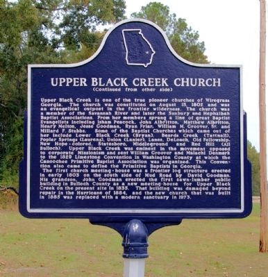
(Continued from other side)
Upper Black Creek is one of the true pioneer churches of Wiregrass Georgia. The church was constituted on August 15, 1802 and was an evangelical outpost in the frontier wilderness. The church was a member of the Savannah River and later the Sunbury and Hephzibah Baptist Associations. From her members sprang a line of great Baptist Evangelists including Isham Peacock, John Albritton, Matthew Albritton Henry Melton, Jesse Goodman, Ryan Friar, William M, Groover, Sr. and Millard F. Stubbs. Some of the Baptist Churches which came out of her include Lower Black Creek (Bryan), Beards Creek (Tattnall), Poplar Springs (Laurens), Union (Lanier), Lanes, DeLoach, Old Fellowship, New Hope-colored, Statesboro, Middleground and Red Hill (All Bulloch). Upper Black Creek was eminent in the movement opposed to corporate Missionism and sent William Groover and Malachi Denmark to the 1829 Limestone Convention in Washington County at which the Canoochee Primitive Baptist Association was organized. This Convention also came to define the Primitive Baptists in Georgia.
The first church meeting-house was a frontier log structure erected in early 1803 on the south side of Mud Road by David Goodman. His grandson, John Goodman erected the first sawn-lumber public building in Bulloch County as a new meeting-house for Upper Black Creek on the present site in 1835. That building was damaged beyond repair in the Hurricane of 1884, and the new church that was built in 1885 was replaced with a modern sanctuary in 1973.
Topics. This historical marker is listed in this topic list: Churches & Religion. A significant historical year for this entry is 1802.
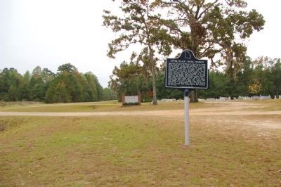
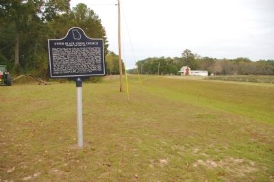
Location. 32° 17.75′ N, 81° 40.767′ W. Marker is near Brooklet, Georgia, in Bulloch County. Marker is on Mud Road, 0.1 miles west of Black Creek Church Road, on the right when traveling west. Touch for map. Marker is at or near this postal address: 2925 Mud Road, Brooklet GA 30415, United States of America. Touch for directions.
Other nearby markers. At least 8 other markers are within 8 miles of this marker, measured as the crow flies. Upper Black Creek Primitive Baptist Church (within shouting distance of this marker); John Abbot (1751-1839) (approx. 4.6 miles away); John Abbot 1751 - 1840 (approx. 4.8 miles away); Nevils Station & Shearwood Railroad (approx. 5.2 miles away); Brooklet, Georgia (approx. 5.9 miles away); Harville House
(approx. 5.9 miles away); Stilson, Georgia (approx. 7.8 miles away); Kiwanis Ogeechee Fair / Kiwanis Club of Statesboro (approx. 8 miles away). Touch for a list and map of all markers in Brooklet.
Photographed By David Seibert, November 3, 2010
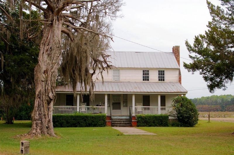
6. The John Goodman House
The house is about 1/4 mile east of the marker, and was built in the early 1830s. Goodman was the grandson of the builder of the first (log) Upper Black Creek Church building, and built a sawn lumber church on the present site in 1835.
Credits. This page was last revised on November 6, 2017. It was originally submitted on December 1, 2010, by David Seibert of Sandy Springs, Georgia. This page has been viewed 1,907 times since then and 43 times this year. Photos: 1, 2, 3, 4, 5. submitted on December 1, 2010, by David Seibert of Sandy Springs, Georgia. 6. submitted on November 6, 2017, by David Seibert of Sandy Springs, Georgia. • Craig Swain was the editor who published this page.
