Jeffersonville in Twiggs County, Georgia — The American South (South Atlantic)
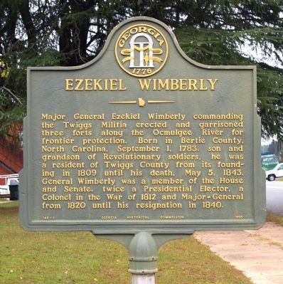
Ezekiel Wimberley
Erected 1955 by Georgia Historical Commission. (Marker Number 143-7.)
Topics and series. This historical marker is listed in these topic lists: Forts and Castles • Government & Politics • Settlements & Settlers • Wars, US Indian. In addition, it is included in the Georgia Historical Society series list. A significant historical month for this entry is May 1941.
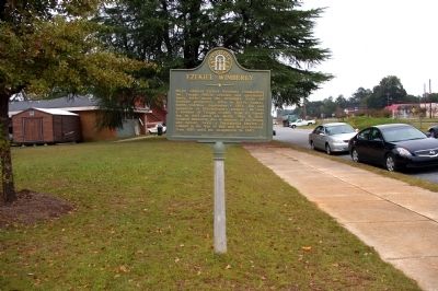
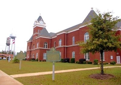
Location. 32° 41.233′ N, 83° 20.733′ W. Marker is in Jeffersonville, Georgia, in Twiggs County. Marker is on North Railroad Street, 0 miles east of Magnolia Street (Georgia Route 96), on the left when traveling east. The marker stands on the south lawn of the Twiggs County Courthouse. Touch for map. Marker is in this post office area: Jeffersonville GA 31044, United States of America. Touch for directions.
Other nearby markers. At least 8 other markers are within 10 miles of this marker, measured as the crow flies. Twiggs County (here, next to this marker); Twiggs County Civil War Monument (within shouting distance of this marker); Richland Baptist Church (approx. 5.1 miles away); Geographic Center of Georgia (approx. 5.6 miles away); Myricks Mill (approx. 7.6 miles away); Dudley M. Hughes (approx. 8.4 miles away); Intersection of Carolina West Florida, and Savannah Lower Creek Indian Trails (approx. 9.6 miles away); Arthur Fort, 1750-1833 (approx. 9.6 miles away). Touch for a list and map of all markers in Jeffersonville.
Credits. This page was last revised on June 16, 2016. It was originally submitted on December 5, 2010, by David Seibert of Sandy Springs, Georgia. This page has been viewed 866 times since then and 50 times this year. Photos: 1, 2, 3. submitted on December 5, 2010, by David Seibert of Sandy Springs, Georgia. • Craig Swain was the editor who published this page.


