Glen Burnie in Anne Arundel County, Maryland — The American Northeast (Mid-Atlantic)
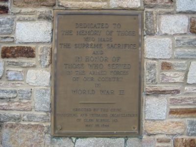
World War II
Erected 1946 by Civic Fraternal and Veterans Organizations of Glen Burnie, MD.
Topics. This historical marker is listed in these topic lists: Military • War, World II.
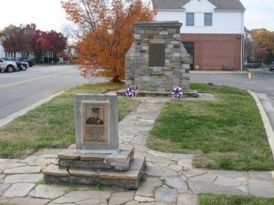
Location. 39° 9.856′ N, 76° 37.583′ W. Marker is in Glen Burnie, Maryland, in Anne Arundel County. Marker is at the intersection of Central Avenue and Platzer Lane, on the right when traveling west on Central Avenue. Touch for map. Marker is in this post office area: Glen Burnie MD 21061, United States of America. Touch for directions.
Other nearby markers. At least 8 other markers are within 2 miles of this marker, measured as the crow flies. Defending the Chesapeake Bay (about 400 feet away, measured in a direct line); World War 1917 (about 400 feet away); St. Alban's Episcopal Church (about 500 feet away); Sgt. Ronald M. Randazzo (approx. 0.2 miles away); Recreation Acres (approx. half a mile away); To All Who Served (approx. half a mile away); Harundale Mall (approx. 1.1 miles away); Ferndale, Maryland (approx. 1˝ miles away). Touch for a list and map of all markers in Glen Burnie.
Credits. This page was last revised on June 16, 2016. It was originally submitted on November 30, 2007, by F. Robby of Baltimore, Maryland. This page has been viewed 1,506 times since then and 27 times this year. Photos: 1, 2, 3. submitted on November 30, 2007, by F. Robby of Baltimore, Maryland.


