Near St. Stephen in Berkeley County, South Carolina — The American South (South Atlantic)
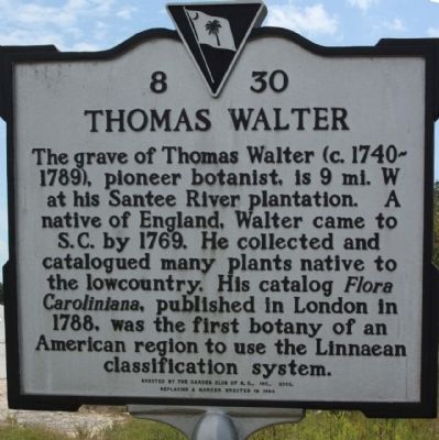
Thomas Walter
Photographed by Mike Stroud, 2009
1. Thomas Walter Marker
Erected 2003 by the Garden Club of S.C., Inc. replacing a marker erected in 1994. (Marker Number 8-30.)
Topics. This historical marker is listed in this topic list: Horticulture & Forestry. A significant historical year for this entry is 1769.
Location. 33° 26.33′ N, 79° 59.1′ W. Marker is near St. Stephen, South Carolina, in Berkeley County. It is at the intersection of Colonel Mamham Dr. and U.S. 52, on the right when traveling east on Colonel Mamham Dr.. Highway has been modified and intersection re-engineered in early 2010, since this marker was first published. Includes road name changes as well.[ed.]. Touch for map. Marker is in this post office area: Saint Stephen SC 29479, United States of America. Touch for directions.

Regionally, this marker is in the Lowcountry and in Santee
this page online
Other nearby markers. At least 8 other markers are within 4 miles of this marker, measured as the crow flies: S.C.O.P.E. Freedom House (approx. 0.9 miles away); Maham Plantation (approx. 2 miles away); Maham Plantation / Col. Hezekiah Maham (approx. 2.3 miles away); DeWitt Williams Bridge (approx. 2½ miles away); Village of Pineville (approx. 2.7 miles away); St. Stephens Veterans Monument (approx. 3.8 miles away); Murray's Ferry - Santee River (approx. 3.9 miles away); Berkeley County (approx. 3.9 miles away).
Also see . . . Linnaean - Biological classification, From Wikipedia. Biological classification or scientific classification in biology is a method by which biologists group
Photographed by Mike Stroud, September 15, 2009
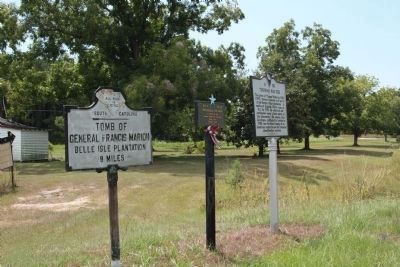
2. Thomas Walter Marker shares location with a Blue Star By-Way marker
Photographed by Mike Stroud, September 15, 2009
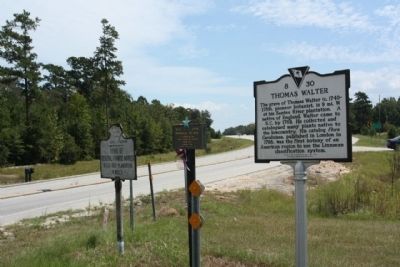
3. Thomas Walter Marker, looking south along US 52

Photographed by Devry Becker Jones (CC0), May 21, 2026
4. Nearby Signage
General Francis Marion
Belle Isle Plantation
8 miles

Photographed by Devry Becker Jones (CC0), May 21, 2026
5. Adjacent Blue Star Memorial Highway signage
Credits. This page was last revised on May 25, 2026. It was originally submitted on October 9, 2009, by Mike Stroud of Bluffton, South Carolina. This page has been viewed 4,151 times since then and 89 times this year. Last updated on December 15, 2010, by David Bullard of Seneca, South Carolina. Photos: 1, 2, 3. submitted on October 9, 2009, by Mike Stroud of Bluffton, South Carolina. 4, 5. submitted on May 25, 2026, by Devry Becker Jones of Washington, District of Columbia.
