Near McClellanville in Charleston County, South Carolina — The American South (South Atlantic)
St. James Santee Parish Church
[Front]
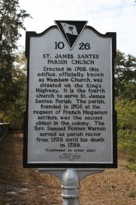
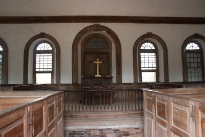
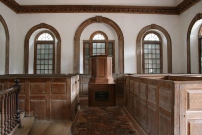
Erected in 1768, this edifice, officially known as Wambaw Church, was situated on the King's Highway. It is the fourth church to serve St. James Santee Parish. The parish, founded in 1706 at the request of French Huguenot settlers, was the second oldest in the colony. The Rev. Samuel Fenner Warren served as parish rector from 1758 until his death in 1789.
[Reverse]
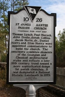
Erected 1996 by St. James Santee Historical Society. (Marker Number 10-26.)
Topics and series. This historical marker is listed in this topic list: Churches & Religion. In addition, it is included in the National Historic Landmarks series list. A significant historical year for this entry is 1768.
Location. 33° 10.303′ N, 79° 27.926′ W. Marker is near McClellanville, South Carolina, in Charleston County. Marker is on Old Georgetown Rd. (dirt), on the right when traveling south. Touch for map. Marker is in this post office area: Mc Clellanville SC 29458, United States of America. Touch for directions.
Other nearby markers. At least 8 other markers are within 7 miles of this marker, measured as the crow flies. Thomas Pinckney / St. James, Santee (approx. 3 miles away); Hopsewee (approx. 5.6 miles away); The Oaks Plantation (approx. 5.9 miles away); St. James Santee Parish Veterans Memorial (approx. 5.9 miles away); Richard Tillia Morrison (approx. 5.9 miles away); Deerhead Oak (approx. 6 miles away); McClellanville (approx. 6 miles away); Point Plantation (approx. 6.1 miles away). Touch for a list and map of all markers in McClellanville.
Regarding St. James Santee Parish Church. National Register of Historic Places:
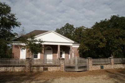
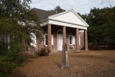
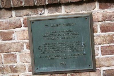
St. James’ Church, erected in 1768, is an excellent example of the effort made in the last third of the 18th century to give South Carolina’s small Georgian brick crossroad churches, with typical rectangular plans, a more sophisticated exterior design. The building and its interiors, including a revised seating plan, appear to be original. The exterior includes architectural features not found in earlier brick country churches built on similar rectangular plans. The hipped-roof Georgian body of St. James’ is preceded, both front and rear, by classic pedimented porticoes, each three bays wide. The eight brick columns have molded bases and capitals, and the shafts, built up in perfect circles, display both diminution and entasis. The main entrance is located in the center of the long south elevation and there is a side door in the center of the west end. Originally there may have also been a center door in the long north side, at the point now occupied by the brick vestry room. The doors and windows are topped by fanlights and brick round arches, a Palladian window is situated in the center of the east end. Listed in the National Register April 15, 1970; Designated a National Historic Landmark April 15, 1970. (S.C. Dept. of Archives and History)
Credits. This page was last revised on June 16, 2016. It was originally submitted on December 16, 2010, by David Bullard of Seneca, South Carolina. This page has been viewed 2,451 times since then and 62 times this year. Photos: 1, 2, 3, 4, 5, 6, 7, 8. submitted on December 16, 2010, by David Bullard of Seneca, South Carolina. • Syd Whittle was the editor who published this page.
