East Dover Hundred in Kent County, Delaware — The American Northeast (Mid-Atlantic)
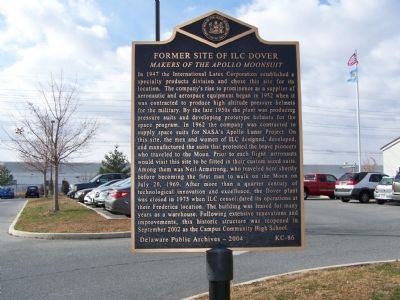
Former Site of ILC Dover
Makers of the Apollo Moonsuit
Photographed by Bill Pfingsten, December 15, 2010
1. Former Site of ILC Dover Marker
Inscription.
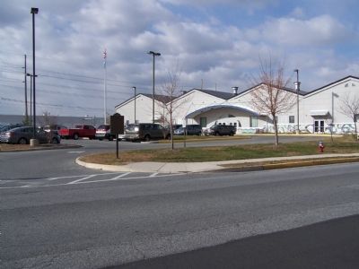
In 1947 the International Latex Corporation established a specialty products division and chose this site for its location. The company’s rise to prominence as a supplier of aeronautic and aerospace equipment began in 1952 when it was contracted to produce high altitude pressure helmets for the military. By the late 1950s the plant was producing pressure suits and developing prototype helmets for the space program. In 1962 the company was contracted to supply space suits for NASA’s Apollo Lunar Project. On this site, the men and women of ILC designed, developed, and manufactured the suits that protected the brave pioneers who traveled to the Moon. Prior to each flight, astronauts would visit this site to be fitted in their custom sized suits. Among them was Neil Armstrong, who traveled here shortly before becoming the first man to walk on the Moon on July 20, 1969. After more than a quarter century of technological innovation and excellence, the Dover plant was closed in 1975 when ILC consolidated its operations at their Frederica location. The building was leased for many years as a warehouse. Following extensive renovations
Click or scan to see this page online
and improvements, this historic structure was reopened in September 2002 as the Campus Community High School.
Erected 2004 by Delaware Public Archives. (Marker Number KC-86.)
Location. 39° 9.883′ N, 75° 32.177′ W. Marker is in Dover, Delaware, in Kent County. It is in East Dover Hundred. It is on Pear Street. Touch for map. Marker is at or near this postal address: 350 Pear Street, Dover DE 19904, United States of America. Touch for directions.
Regionally, this marker is in the American Mid-Atlantic, on the Delmarva Peninsula, and on the Eastern Seaboard. Globally, it is in the North Atlantic Region, North America, the Western Hemisphere, the Western World, and the Anglosphere. Historically, it finds itself in what was once New Netherland, one of the original Thirteen Colonies, and the Antebellum South.
Credits. This page was last revised on May 15, 2026. It was originally submitted on December 17, 2010, by Bill Pfingsten of Bel Air, Maryland. This page has been viewed 1,424 times since then and 31 times this year. Photos:1, 2. submitted on December 17, 2010, by Bill Pfingsten of Bel Air, Maryland.