Gardendale in Jefferson County, Alabama — The American South (East South Central)
Gardendale, Alabama
Photographed by David J Gaines, November 17, 2010
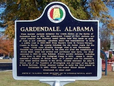
1. Gardendale, Alabama Marker - Side A
Side A
When Andrew Jackson defeated the Creek Nation at the Battle of Horseshoe Bend in 1814, the subsequent Treaty of Fort Jackson and other treaties that followed ceded Indian land that made up most of what is now Alabama. Abraham Stout was commissioned to build a public road in 1822-1823 from Gandy’s Cove in Cataco/Morgan County to Elyton. He closely followed the old Indian trails for the Route, which came directly through what is now Gardendale. Pioneers had already arrived in the area and after the completion of Stout’s Road, some had settled and purchased land here, the first recorded in 1824 by John Belcher. Others quickly followed, including Otis Dyer in 1828 and Zachariah Stagg in 1834. James K. Jacks operated a tollgate on Stout’s Road, as it passed near his plantation. Coal mines opened nearby in the 1870s, several operated by John T. Millner, one of the founders of Birmingham and surveyor of the South & North Railroad. Millner donated lumber to build the first school in Gardendale in 1892, which was named Millner School.
Side B
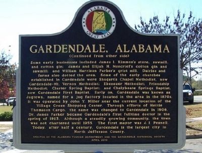
Some early businesses included James I. Kimmon’s store, sawmill, and cotton gin;
this page online
Erected 2010 by Alabama Tourism Department and the Gardendale Historical Society.
Topics and series. This historical marker is listed in this topic list: Settlements & Settlers. In
Photographed by David J Gaines, November 17, 2010
2. Gardendale, Alabama Marker - Side B
Location. 33° 38.862′ N, 86° 48.678′ W. Marker is in Gardendale, Alabama, in Jefferson County. It is at the intersection of Main Street and Bell Street, on the right when traveling north on Main Street. Touch for map. Marker is in this post office area: Gardendale AL 35071, United States of America. Touch for directions.

Regionally, this marker is in the Birmingham Metropolitan Area. It is also in the American South and specifically in the Deep South. Globally, it is in North America, a Gulf of Mexico state, the Western Hemisphere, the Western World, and the Anglosphere. Historically, it finds itself in what was once the territory of the Mississippian Culture, one of the Confederate States of America, and the Antebellum South.
Other nearby markers. At least 8 other markers are within 7 miles of this marker, measured as the crow flies: Virgil Allen Howard (a few steps from this marker); Black Creek Park, Five Mile Creek Greenway Partnership and the Fultondale Coke Oven Park (approx. 1.9 miles away); Tarrant City Hall
Photographed by David J Gaines, November 17, 2010
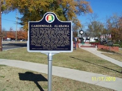
3. Gardendale, Alabama Marker
More about this marker. The marker is located in the northwest corner of Gardendale's Millennium Park.
Credits. This page was last revised on May 9, 2021. It was originally submitted on December 18, 2010, by David J Gaines of Pinson, Alabama. This page has been viewed 2,630 times since then and 192 times this year. Photos: 1, 2, 3. submitted on December 18, 2010, by David J Gaines of Pinson, Alabama. • Bill Pfingsten was the editor who published this page.
