Gadsden in Etowah County, Alabama — The American South (East South Central)
Gadsden, Alabama
Photographed by Tim & Renda Carr, December 18, 2010
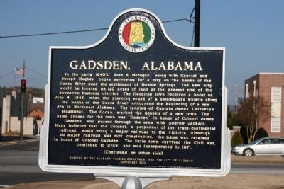
1. Gadsden, Alabama Marker (Side A)
Side A:
In the early 1840’s, John S. Moragne, along with Gabriel and Joseph Hughes, began surveying for a city on the banks of the Coosa River near the settlement of Double Springs. The new city would be located on 120 acres of land at the present site of the downtown business district. The fledgling town received a boost on July 4, 1845, when the piercing sound of a steamboat’s whistle along the banks of the Coosa River announced the beginning of a new era in Northeast Alabama. The landing of Captain James Lafferty’s steamboat. The Coosa, marked the genesis of a new town. The name chosen for the town was “Gadsden” in honor of Colonel James Gadsden, who passed through the area with Andrew Jackson. Many believed that the Colonel, a proponent of the trans-continental railroad, would bring a major railroad to the vicinity. Although no major railroad was ever constructed, the name was retained in honor of Colonel Gadsden. The little town survived the Civil War, continued to grow, and was incorporated in 1871.
Side B:
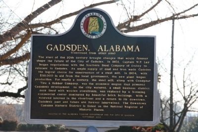
The start of the 20th century brought changes that would forever shape the future of the City
this page online
Topics and series. This historical marker is listed in these topic lists: Industry & Commerce • Notable Places • Settlements & Settlers. In addition, it is included in the Former U.S. Presidents: #07 Andrew Jackson series list. A significant historical month for this entry is July 1863.
Location. 34° 0.65′ N, 85° 59.997′ W.
Photographed by Tim & Renda Carr, December 18, 2010
2. Gadsden, Alabama Marker (Side B)

Regionally, this marker is in North Alabama. It is also in the American South, specifically in the Deep South, in Appalachia, and specifically in Southern Appalachia. Globally, it is in North America, a Gulf of Mexico state, the Western Hemisphere, the Western World, and the Anglosphere. Historically, it finds itself in what was once the original Cherokee Nation, the territory of the Mississippian Culture, one of the Confederate States of America, and the Antebellum South.
Other nearby markers. At least 8 other markers are within walking distance of this marker: Emma Sansom Monument (within shouting distance of this marker); Paul Harvey Loyalty Day (within shouting distance of this marker); John H. Wisdom (within shouting distance of this marker); Lynching in America / The Lynching of Bunk Richardson (about 500 feet away, measured
Photographed by Tim & Renda Carr, December 18, 2010
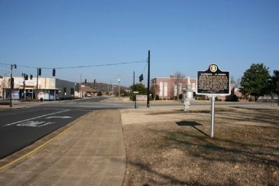
3. Gadsden, Alabama Marker near the Intersection of 1st Street and Broad Street
Photographed by Tim & Renda Carr, December 18, 2010
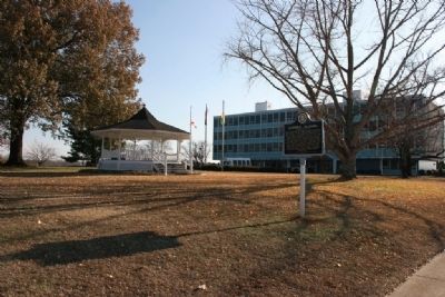
4. Gadsden, Alabama Marker Stands Near Gadsden City Hall
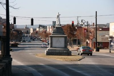
Photographed by Tim & Renda Carr, December 18, 2010
5. Looking West Along Broad Street, Gadsden, Alabama
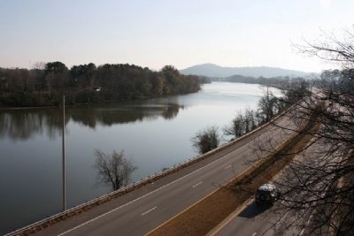
Photographed by Tim & Renda Carr, December 18, 2010
6. Downstream View of The Coosa River. Gadsden, Alabama
Credits. This page was last revised on September 29, 2020. It was originally submitted on December 19, 2010, by Timothy Carr of Birmingham, Alabama. This page has been viewed 3,528 times since then and 117 times this year. Photos: 1, 2, 3, 4, 5, 6. submitted on December 19, 2010, by Timothy Carr of Birmingham, Alabama. • Bill Pfingsten was the editor who published this page.
