South of Broad in Charleston in Charleston County, South Carolina — The American South (South Atlantic)
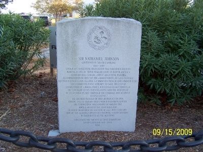
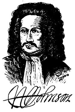
Sir Nathaniel Johnson
Governor of South Carolina
— 1703 – 1709 —
Under his direction, Charleston was fortified, thereby making it one of three walled cities in North America, after Quebec, Canada and St. Augustine, Florida. As commander in chief of the armed forces, he successfully defended Charleston against a combined French and Spanish fleet. “Thus ended the first attempt to take the city of Charleston by a naval force, which failed, not through the strength of its fortifications nor the multitude of its defenders, but through the courage and activity of its citizens.” He secured passage of the Church Act of 1706, ending the sectarian strife which had been sapping the strength of the colony by making the Anglican faith the state religion. He first promoted the culture of silk which became one of the leading exports of colonial South Carolina. He died in 1713 at the age of 68.
Erected 1984 by Society of First Families of South Carolina 1600 – 1700.
Topics. This historical marker is listed in these topic lists: Churches & Religion • Colonial Era • Forts and Castles • Settlements & Settlers. A significant historical year for this entry is 1706.
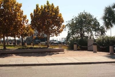
Location. 32° 46.534′ N, 79° 55.543′ W. Marker is in Charleston, South Carolina, in Charleston County. It is in South of Broad. Marker is on Concord Street near N Adgers Wharf, on the right when traveling north. Touch for map. Marker is in this post office area: Charleston SC 29401, United States of America. Touch for directions.
Other nearby markers. At least 8 other markers are within walking distance of this marker. One North Adger's Wharf (within shouting distance of this marker); As Old as Charleston (about 400 feet away, measured in a direct line); The Tavern (about 400 feet away); 90 East Bay Street Ancrum Wharf Building (about 400 feet away); 83-107 East Bay Street Rainbow Row (about 500 feet away); Col. Othneil Beale's House (about 500 feet away); Convention on Ratification (about 500 feet away); Walker, Evans & Cogswell Company (about 600 feet away). Touch for a list and map of all markers in Charleston.
Credits. This page was last revised on February 16, 2023. It was originally submitted on December 21, 2010. This page has been viewed 876 times since then and 57 times this year. Photos: 1. submitted on December 21, 2010. 2. submitted on October 7, 2011, by Mike Stroud of Bluffton, South Carolina. 3. submitted on March 2, 2021, by Larry Gertner of New York, New York. • Bill Pfingsten was the editor who published this page.


