Near Fort Oglethorpe in Walker County, Georgia — The American South (South Atlantic)
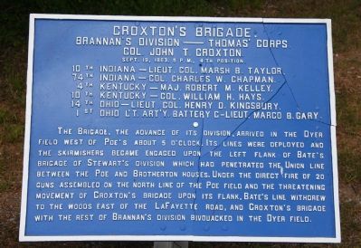
Croxton's Brigade.
Brannan's Division — Thomas' Corps.
— Col. John T. Croxton. —
Brannan's Division — Thomas' Corps.
Col. John T. Croxton
Sept. 19, 1863, 5 P.M., 4th Position.
10th Indiana - Lieut. Col. Marsh B. Taylor.
74th Indiana - Col. Charles W. Chapman.
4th Kentucky - Maj. Robert M. Kelley
10th Kentucky - Col. William H. Hays.
14th Ohio - Lieut. Col. Henry D. Kingsbury.
1st Ohio L't. Art'y. Battery C - Lieut. Marco B. Gary.
•
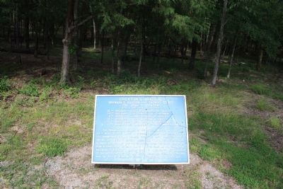
The Brigade, the advance of its division, arrived in the Dyer Field west of Poe's about 5 o'clock. Its lines were deployed and the skirmishers became engaged upon the left flank of Bate's Brigade of Stewart's Division which had penetrated the Union line between the Poe and Brotherton houses. Under the direct fire of 20 guns assembled on the north line of the Poe Field and the threatening movement of Croxton's Brigade upon its flank, Bate's line withdrew to the woods east of the LaFayette Road, and Croxton's Brigade with the rest of Brannan's Division bivouacked in the Dyer Field.
Erected 1890 by the Chickamauga and Chattanooga National Military Park Commission. (Marker Number MT-571.)
Topics. This historical marker is listed in this topic list: War, US Civil. A significant historical date for this entry is September 19, 1863.
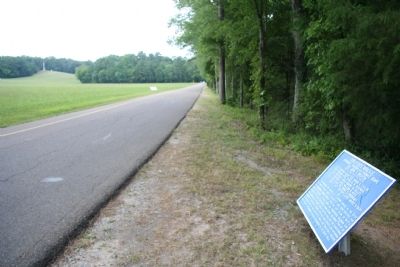
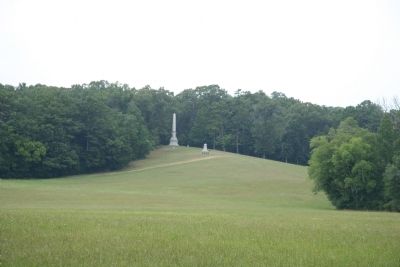
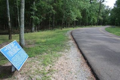
Location. 34° 55.219′ N, 85° 15.867′ W. Marker is near Fort Oglethorpe, Georgia, in Walker County. Marker is on Glenn-Kelly Road north of Dyer Road, on the right when traveling north. This historical marker is located in the national park that preserves the site of the Chickamauga Battlefield, along the east side of the Glenn-Kelly Road. Touch for map. Marker is in this post office area: Fort Oglethorpe GA 30742, United States of America. Touch for directions.
Other nearby markers. At least 8 other markers are within walking distance of this marker. Kershaw's Brigade (within shouting distance of this marker); Longstreet's Corps (within shouting distance of this marker); The Wounding of Hood Site (within shouting distance of this marker); Bledsoe's C.S.A. Missouri Battery (within shouting distance of this marker); Van Derveer's Brigade (about 300 feet away, measured in a direct line); Hood's Headquarters Shell Monument (about 400 feet away); John B. Hood (about 400 feet away); Brannan's Division (about 500 feet away). Touch for a list and map of all markers in Fort Oglethorpe.
More about this marker. I used the "Chickamauga Battlefield" map, that I purchased at the Chickamauga and Chattanooga National Military Park, Visitor Center, to determine both the monument number for this marker and the marker's location in relation to the rest of the park's monuments, markers, and tablets. According to the map it provides the,
"numerical listing of all monuments, markers, and tablets on the Chickamauga Battlefield (using the Chick-Chatt NMP Monument Numbering System).”
Credits. This page was last revised on July 3, 2017. It was originally submitted on December 24, 2010, by Dale K. Benington of Toledo, Ohio. This page has been viewed 866 times since then and 48 times this year. Photos: 1, 2, 3. submitted on December 24, 2010, by Dale K. Benington of Toledo, Ohio. 4, 5. submitted on January 10, 2013, by Dale K. Benington of Toledo, Ohio.
