
Near Colstrip in Rosebud County, Montana — The American West (Mountains)
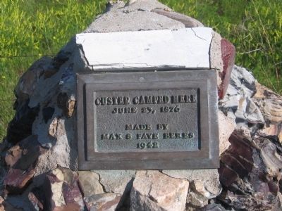
Custer Camped Here
General George Armstrong Custer Encampment
Photographed by Robert L Weber
1. Custer Camped Here Marker
June 23, 1876
Erected 1942 by Max & Faye Beres.
Topics. This historical marker is listed in these topic lists: Military • Wars, US Indian. A significant historical date for this entry is June 23, 1876.
Location. 45° 45.448′ N, 106° 35.983′ W. Marker is near Colstrip, Montana, in Rosebud County. It is on State Highway 39 11.9 miles north of U.S. 212, on the left when traveling north. Touch for map. Marker is in this post office area: Forsyth MT 59327, United States of America. Touch for directions.

Regionally, this marker is in Montana’s Northern Cheyenne Nation, in Southeast Montana, in Custer Country and in the Powder River Basin. It is also in the American Mountain West, in the Lewis & Clark Corridor, on the prairies, on the Great Plains, and specifically on the Northern Plains. Globally, it is in North America, the Western Hemisphere, the Western World, and the Anglosphere. Historically, it finds itself in what was once Rupert’s Land and also the Louisiana Purchase.
Also see . . . Custer Battlefield Museum. The museum website offers additional information with
this page online
Photographed by Robert L Weber
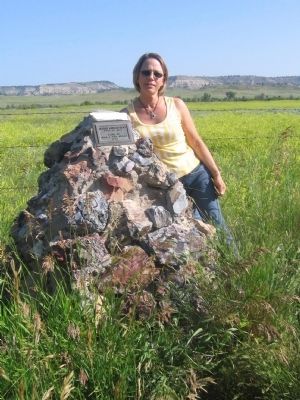
2. Custer Camped Here Marker
Credits. This page was last revised on June 16, 2016. It was originally submitted on December 26, 2010, by Bob (peach) Weber of Dewey, Arizona. This page has been viewed 1,721 times since then and 58 times this year. Photos: 1, 2. submitted on December 26, 2010, by Bob (peach) Weber of Dewey, Arizona. • Syd Whittle was the editor who published this page.
