Cañon City in Fremont County, Colorado — The American Mountains (Southwest)
Royal Gorge Bridge
Photographed by Robert L Weber, July 15, 2006
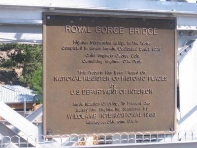
1. Royal Gorge Bridge Marker
Completed in seven months - Dedicated Dec. 7, 1929
Chief Engineer George Cole
Consulting Engineer O.K. Peck
This property has been placed on
National Register of Historic Places
By
U.S. Department of Interior
Modernization of bridge to present day
safety and engineering standards by
Wilolamb International - 1983
Muskogee, Oklahoma U.S.A.
Topics. This historical marker is listed in this topic list: Bridges & Viaducts. A significant historical date for this entry is December 7, 1929.
Location. 38° 27.683′ N, 105° 19.52′ W. Marker is in Cañon City, Colorado, in Fremont County. It is on County Road 3A, on the left when traveling east. Touch for map. Marker is in this post office area: Canon City CO 81212, United States of America. Touch for directions.

Regionally, this marker is in the Arkansas River Valley and in Pikes Peak Region. It is also in the American Mountain West. Globally, it is in North America, the Rocky Mountains, the Western Hemisphere, the Western World, and the Anglosphere. Historically, it finds itself in what was once the Comanchería and also the Republic of
this page online
Other nearby markers. At least 8 other markers are within 5 miles of this marker, measured as the crow flies: Royal Gorge (about 700 feet away, measured in a direct line); How the Bridge Became Royal (approx. 0.2 miles away); Zebulon Pike Block House (approx. 3.8 miles away); Colorado Territorial Prison (approx. 4½ miles away); Canon City - Bustling Center for Trade, Transportation, and Tourism (approx. 4.7 miles away); Lt. Zebulon Pike's Southwestern Expedition (approx. 4.7 miles away); The Gold Belt Tour National Scenic Byway (approx. 4.7 miles away); Filmed in Cañon (approx. 4.7 miles away). Touch for a list and map of all markers in Cañon City.
Also see . . . History of the Royal Gorge Bridge. Site also offers links to additional information. (Submitted on January 1, 2011, by Bob (peach) Weber of Dewey, Arizona.)
Photographed by Robert L Weber, July 15, 2006
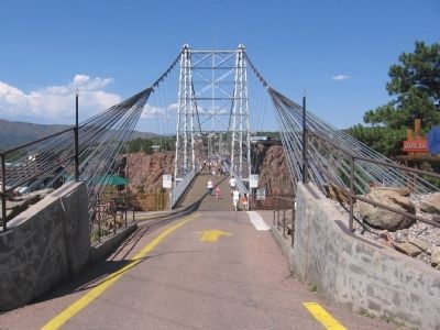
2. Royal Gorge Bridge
Photographed by Robert L Weber, July 15, 2006
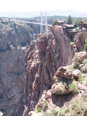
3. Royal Gorge Bridge
Photographed by Robert L Weber, July 15, 2006
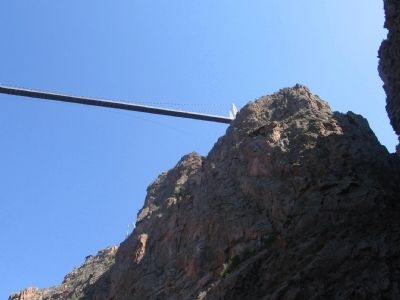
4. Royal Gorge Bridge from below
Photographed by Robert L Weber, July 15, 2006
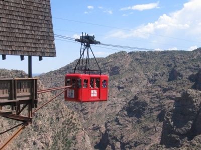
5. The other way across the gorge
The gondola's have been updated since this one.
Photographed by Robert L Weber, July 15, 2006
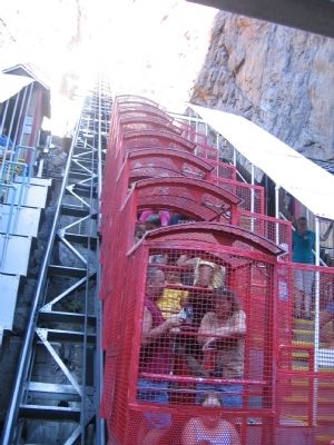
6. The only way down
Credits. This page was last revised on September 10, 2023. It was originally submitted on December 27, 2010, by Bob (peach) Weber of Dewey, Arizona. This page has been viewed 1,693 times since then and 40 times this year. Photos: 1, 2, 3, 4, 5, 6. submitted on December 27, 2010, by Bob (peach) Weber of Dewey, Arizona. • Syd Whittle was the editor who published this page.
