Tompkinsville in Monroe County, Kentucky — The American South (East South Central)
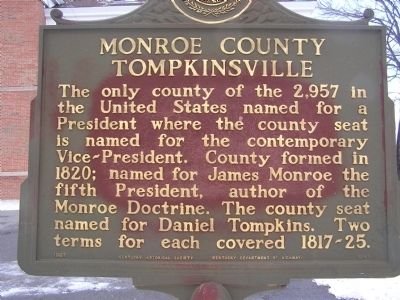
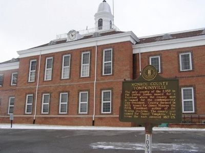
Monroe County - Tompkinsville
Erected 1967 by Kentucky Historical Society - Kentucky Department of Highways. (Marker Number 1093.)
Topics and series. This historical marker is listed in these topic lists: Government & Politics • Settlements & Settlers. In addition, it is included in the Former U.S. Presidents: #05 James Monroe, and the Kentucky Historical Society series lists. A significant historical year for this entry is 1820.
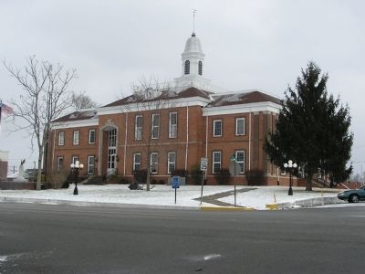
Location. 36° 42.058′ N, 85° 41.538′ W. Marker is in Tompkinsville, Kentucky, in Monroe County. Marker is at the intersection of South Main Street (State Highway 100) and 3rd Street, on the right when traveling north on South Main Street. Located in the courthouse lawn on Main Street. Touch for map. Marker is in this post office area: Tompkinsville KY 42167, United States of America. Touch for directions.
Other nearby markers. At least 8 other markers are within 2 miles of this marker, measured as the crow flies. Courthouse Burned (here, next to this marker); Monroe County World War I Memorial (a few steps from this marker); Monroe County World War II Memorial (a few steps from this marker); Monroe County Korean & Vietnam War Memorial (within shouting distance of this marker); Battle of Tompkinsville (approx. 0.3 miles away); Tompkinsville National Cemetery (approx. 0.3 miles away); Operation Iraqi Freedom Monument (approx. 1.4 miles away); Hannah Boone Pennington (approx. 1.7 miles away). Touch for a list and map of all markers in Tompkinsville.
Credits. This page was last revised on June 16, 2016. It was originally submitted on January 1, 2011, by Chad Comer of Gamaliel, Kentucky. This page has been viewed 738 times since then and 21 times this year. Photos: 1, 2, 3. submitted on January 8, 2011, by Chad Comer of Gamaliel, Kentucky. • Craig Swain was the editor who published this page.


