North Murderkill Hundred in Camden in Kent County, Delaware — The American Northeast (Mid-Atlantic)
Star Hill A.M.E. Church
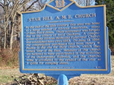
Photographed by Bill Pfingsten, December 15, 2010
1. Star Hill A.M.E. Church Marker
Erected 1993 by Delaware Public Archives. (Marker Number K-50.)
Topics and series. This historical marker is listed in these topic lists: African Americans • Religion & Religious Structures • Settlements & Settlers. In addition, it is included in the African Methodist Episcopal (AME) Church, the Delaware Public Archives, and the Quakerism series lists. A significant historical month for this entry is June 1859.
Location. 39° 6.126′ N, 75° 32.157′ W. Marker is in Camden, Delaware, in Kent County. It is in North Murderkill
this page online

Regionally, this marker is in the American Mid-Atlantic, on the Delmarva Peninsula, and on the Eastern Seaboard. Globally, it is in the North Atlantic Region, North America, the Western Hemisphere, the Western World, and the Anglosphere. Historically, it finds itself in what was once New Netherland, one of the original Thirteen Colonies, and the Antebellum South.
Other nearby markers. At least 8 other markers are within one mile of this marker, measured as the crow flies: Site of Whatcoat Church (approx. 0.8 miles away); Camden (approx. 0.8 miles away); Gov. George Truitt Home (approx. 0.8 miles away); a different marker also named Camden (approx. 0.9 miles away); Morning Star Institutional Church of God in Christ, Inc. (approx. 0.9 miles away); Brinkley Hill (approx. 1.1 miles away); Camden Friends Meeting (approx. 1.1 miles away); John Hunn (approx. 1.1 miles away). Touch for a list and map
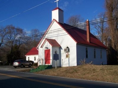
Photographed by Bill Pfingsten, December 15, 2010
2. Star Hill A.M.E. Church
Credits. This page was last revised on July 25, 2026. It was originally submitted on January 9, 2011, by Bill Pfingsten of Bel Air, Maryland. This page has been viewed 1,290 times since then and 51 times this year. Photos: 1, 2. submitted on January 9, 2011, by Bill Pfingsten of Bel Air, Maryland.
